| Burial Sites in Swanzey, New Hampshire |
|---|
| Note: The sites with "red background" do not look correct on the Google maps corresponding to the lat/long coordinates for that cemetery. The problem may be either incorrect lat/long or changed street names. Please send any corrections to NHOGA Webmaster with corrected lat/longs in degrees/minutes/seconds or degrees + fractional degrees to 6 places. |
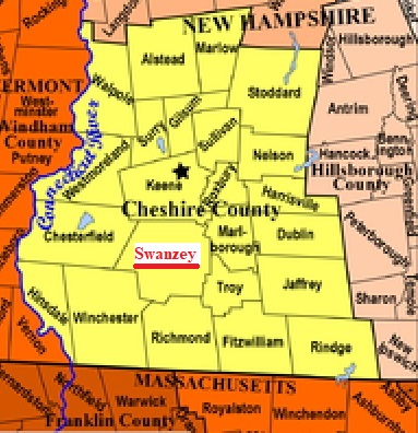
| To see a map of all sites click here. |
| S26-001 Applin, Private cemetery on Old Richmond Rd. between the fire pond and Chimney Hill Rd. (Lat/Long unknown), (Coordinates needed) Source: Morgan Wright, 1997 |
| S26-002 Homestead, Jct. Homestead Ave. and Denman Thompson Highway, USGS Winchester Quadrangle, E71859, N474942, Zone 18 (42° 52' 5"N, 72° 19' 27"W), Source: Morgan Wright, 1997 MAP |
| S26-003 Mountain View, off Route 32, USGS Winchester Quadrangle, E72211, N474861, Zone 18 (42° 51' 35"N, 72° 16' 53"W), At the intersection of Rt. 32 and Hackler Drive. Source: Morgan Wright, 1997 MAP |
| S26-004 Mt. Caesar, off Route 32, USGS Winchester Quadrangle, E72182, N474998, Zone 18 (42° 52' 20"N, 72° 17' 4"W), Source: Morgan Wright, 1997 MAP |
| S26-005 Oak Hill, The driveway runs north at the intersection of Pine St. & Eaton Road, USGS Winchester Quadrangle, E71876, N474985, Zone 18 (42° 52' 18.69"N, 72° 19' 18.52"W), (GPS: 42.8719040°N, 72.3213520°W), This cemetery in West Swanzey if shown on both Winchester and Keene maps. Source: Morgan Wright 1997, updated: Sandy Sliviak, 2016 MAP |
| S26-006 Westport, Jct. Homestead Ave. and Westport Village Road, USGS Winchester Quadrangle, E71765, N474698, Zone 18 (42° 50' 47"N, 72° 20' 11"W), Source: Morgan Wright, 1997 MAP |
| S26-007 Willard, off Lake Street, Removed, USGS Keene Quadrangle, (Coordinates needed) (Exact location unknown), This site in North Swanzey has no remains left according to Wright. Source: Morgan Wright, 1997 |
Listings Copyright © 1998-2024 New Hampshire Old Graveyard Association.
All rights reserved.
Send mail to webmaster@nhoga.org with questions or comments about this web site.