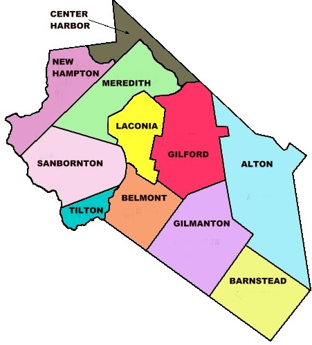


| Burial Sites in Laconia, New Hampshire |
|---|
| Note: The sites with "red background" do not look correct on the Google maps corresponding to the lat/long coordinates for that cemetery. The problem may be either incorrect lat/long or changed street names. Please send any corrections to NHOGA Webmaster with corrected lat/longs in degrees/minutes/seconds or degrees + fractional degrees to 6 places. |
| To see a map of all sites click here. |
| L01-001 Bayside, Union Ave. (Rte. 3), USGS Laconia Quadrangle, E30200, N482600, Zone 19 (43° 33' 45"N, 71° 27' 6"W), Source: NHHS 1975 MAP |
| ------ Beaver Pond, See: Dow, L01-003 |
| L01-014 County Home Cemetery, Lexington Drive, USGS Laconia Quadrangle, E29873, N482389, Zone 19 (43° 32' 34"N, 71° 29' 28"W), Source: City of Laconia 1994 MAP |
| L01-002 Doe, Route 3, USGS Laconia Quadrangle, E30090, N483100, Zone 19 (43° 36' 26"N, 71° 28' 1"W), Source: NHHS 1975 MAP |
| L01-019 Dooley/Robinson, Cotton Hill Road, USGS Laconia Quadrangle, E30221, N482055, Zone 19 (43° 30' 49"N, 71° 26' 49"W), Source: City of Laconia 1994 MAP |
| L01-003 Dow, Roller Coaster Road, USGS Laconia Quadrangle, E29967, N483203, Zone 19 (43° 36' 58"N, 71° 28' 57"W), Source: NHHS 1975 MAP |
| L01-004 Hillside, Mechanic St. USGS Laconia Quadrangle, E30100, N482400, Zone 19 (43° 32' 40"N, 71° 27' 48"W), Source: NHHS 1975 MAP |
| L01-005 Mead, Parade Road, USGS Laconia Quadrangle, E29868, N482739, Zone 19 (43° 34' 27"N, 71° 29' 35"W), Source: NHHS 1975 MAP |
| L01-006 Meredith Bridge, Cook Court, USGS Laconia Quadrangle, E30014, N482178, Zone 19 (43° 31' 27"N, 71° 28' 23"W), Source: City of Laconia 1994 MAP |
| L01-007 Old Town Cemetery, Old Parade Road, USGS Laconia Quadrangle, E29894, N482878, Zone 19 (43° 35' 13"N, 71° 29' 26"W), Source: NHHS 1975 MAP |
| L01-008 Opechee, Parade Rd. (Rte. 106), USGS Laconia Quadrangle, E29851, N482994, Zone 19 (43° 35' 50"N, 71° 29' 46"W), Source: City of Laconia 1994 MAP |
| L01-017 Pitman, Meredith Center Road, USGS Winnisquam Lake Quadrangle, E29683, N482843, Zone 19 (43° 34' 59"N, 71° 30' 59"W), Source: City of Laconia 1994 MAP |
| L01-015 Randlett, Tyler Shore Road, USGS Winnisquam Lake Quadrangle, E29704, N482725, Zone 19 (43° 34' 21"N, 71° 30' 48"W), Source: City of Laconia 1994 MAP |
| L01-009 Robinson, Meredith Center Road, USGS Winnisquam Lake Quadrangle, E29672, N482884, Zone 19 (43° 35' 12"N, 71° 31' 5"W), Source: City of Laconia 1994 MAP |
| L01-016 Robinson, Parade Rd. (Corner Roller Coaster Rd.), USGS Winnisquam Lake Quadrangle, E29682, N482956, Zone 19 (43° 35' 36"N, 71° 31' 1"W), Note: These coordinates place the site on Meredith Center Road, not Parade Road. This site is near the location of the site listed on Find A Grave as the Batchelder Yard Cemetery, but the FAG site does not list any Robinson burials. Source: City of Laconia 1994 MAP |
| ------ Robinson, See: Dooley/Robinson, L01-019 |
| L01-010 Round Bay, Parade Rd. (Rte. 106), USGS Laconia Quadrangle, E29919, N482634, Zone 19 (43° 33' 54"N, 71° 29' 11"W), Source: NHHS 1975 MAP |
| L01-011 Sacred Heart, Garfield St. USGS Laconia Quadrangle, E30070, N482087, Zone 19 (43° 30' 58.04"N, 71° 27' 56.80"W), (GPS: 43.5161694°N, 71.4653167°W), Source: NHHS 1975, updated: David Trubey 2017 MAP |
| L01-012 St. Lambert, Province Road, USGS Laconia Quadrangle, E30135, N482104, Zone 19 (43° 31' 4.17"N, 71° 27' 28.10"W), (GPS: 43.5179333°N, 71.4573639°W), Source: NHHS 1975, updated: Ann Massingham 2018 MAP |
| L01-013 Union, Academy St. USGS Laconia Quadrangle, E30047, N482100, Zone 19 (43° 31' 2"N, 71° 28' 7"W), Source: NHHS 1975 MAP |
| L01-018 WLNH Cemetery, Pickerel Pond Road, USGS Laconia Quadrangle, E29842, N482982, Zone 19 (43° 35' 46"N, 71° 29' 50"W), Source: City of Laconia 1994 MAP |
Listings Copyright © 1998-2024 New Hampshire Old Graveyard Association.
All rights reserved.
Send mail to webmaster@nhoga.org with questions or comments about this web site.
