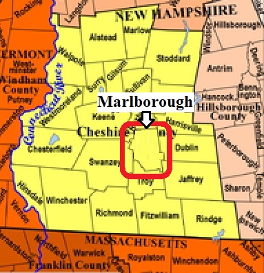


| Burial Sites in Marlborough, New Hampshire |
|---|
| To see a map of all sites click here. |
| ------ Catholic Cemetery, See: Mt. Calvary, M04-001 |
| M04-002 Center Cemetery, south end of Frost Hill Rd. near Rte. 124, USGS Marlborough Quadrangle, E72947, N475172, Zone 18 (42° 53' 7.93"N, 72° 11' 24.29"W), (GPS: 42.8856330°N, 72.1896520°W), Source: Michael Ball, 1997, updated: Sandy Sliviak, 2016 MAP |
| M04-003 East Cemetery, Old Harrisville Road, USGS Marlborough Quadrangle, E73090, N475688, Zone 18 (42° 55' 53"N, 72° 10' 14"W), Source: Michael Ball, 1997 MAP |
| ------ Estey, See: Rhodes, M04-007 |
| M04-004 Graniteville, Granite St. USGS Marlborough Quadrangle, E72798, N475389, Zone 18 (42° 54' 19.80"N, 72° 12' 26.72"W), (GPS: 42.9055890°N, 72.2070001°W), This is beside Pine Grove Source: Michael Ball, 1997, updated: Sandy Sliviak, 2018 MAP |
| ------ Hill Road, See: Center Cemetery, M04-002 |
| ------ Meetinghouse, See: Center Cemetery, M04-002 |
| M04-001 Mt. Calvary, off Main St. (Rte. 101), USGS Marlborough Quadrangle, E72744, N475390, Zone 18 (42° 54' 21"N, 72° 12' 50"W), Source: Michael Ball, 1997 MAP |
| ------ Old Center Cemetery, See: Center Cemetery, M04-002 |
| M04-006 Pine Grove, Granite St. USGS Marlborough Quadrangle, E72798, N475400, Zone 18 (42° 54' 23"N, 72° 12' 27"W), Source: Michael Ball, 1997 MAP |
| M04-007 Rhodes, Hill St. USGS Marlborough Quadrangle, E72770, N475295, Zone 18 (42° 53' 49.67"N, 72° 12' 40.43"W), (GPS: 42.8971950°N, 72.2107880°W), (The name,"Rhodes", came from the farm that was close by according to Marlborough Town Clerk.) Source: Sandy Sliviak, 2016 MAP |
Listings Copyright © 1998-2024 New Hampshire Old Graveyard Association.
All rights reserved.
Send mail to webmaster@nhoga.org with questions or comments about this web site.
