| Burial Sites in Richmond, New Hampshire |
|---|
| Note: The sites with "red background" do not look correct on the Google maps corresponding to the lat/long coordinates for that cemetery. The problem may be either incorrect lat/long or changed street names. Please send any corrections to NHOGA Webmaster with corrected lat/longs in degrees/minutes/seconds or degrees + fractional degrees to 6 places. |
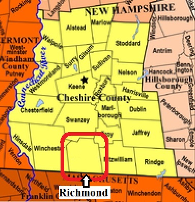
| To see a map of all sites click here. |
| R03-001 Aldrich, Route 32, USGS Winchester Quadrangle, E72324, N474358, Zone 18 (42° 48' 51"N, 72° 16' 10"W), Source: Roger Hunt 1982 MAP |
| R03-016 Ballou, off Green Woods, USGS Winchendon Quadrangle, E72632, N473417, Zone 18 (42° 43' 43"N, 72° 14' 8"W), Source: Roger Hunt 1982 MAP |
| R03-017 Ballou, Green Woods Road, USGS Winchendon Quadrangle, E72590, N473357, Zone 18 (42° 43' 24"N, 72° 14' 28"W), Source: Roger Hunt 1982 MAP |
| R03-014 Barrus, Whipple Hill Road, USGS Northfield Quadrangle, E71992, N473524, Zone 18 (42° 44' 24"N, 72° 18' 48"W), Source: Roger Hunt 1982 MAP |
| R03-004 Benson, Benson Road, above Benson Rd. off Fish Hatchery Road, USGS Monadnock Mountain Quadrangle, E72506, N473996, Zone 18 (42° 46' 51.84"N, 72° 14' 55.39"W), (GPS: 42.7811150°N, 72.2482840°W), Note: This cemetery is at the top of the mountain, about 1 mile up off of Fish Hatchery Rd. First half mile is accessible by car where Benson Rd ends. Unless you have a high clearance 4-wheel drive, it's another half mile uphill by foot. Source: Roger Hunt 1982, updated: Sandy Sliviak 2016 MAP |
| R03-009 Boorn, Rhododendron Road, USGS Monadnock Mountain Quadrangle, E72739, N473725, Zone 18 (42° 45' 22"N, 72° 13' 17"W), Source: Roger Hunt 1982 MAP |
| R03-018 Boyce, near Mass. line, USGS Winchendon Quadrangle, E72808, N473328, Zone 18 (42° 43' 12"N, 72° 12' 52"W), Source: Roger Hunt 1982 MAP |
| ------ Cass, See: Kelton, R03-007 |
| ------ Cass Cemetery, See: South Cemetery, R03-011 |
| R03-015 Ellis, Town Forest, USGS Northfield Quadrangle, E72249, N473477, Zone 18 (42° 44' 6"N, 72° 16' 56"W), Source: Roger Hunt 1982 MAP |
| R03-010 Goddard, off Toad Hollow Road, USGS Northfield Quadrangle, E72094, N473585, Zone 18 (42° 44' 43"N, 72° 18' 2"W), Source: Roger Hunt 1982 MAP |
| R03-012 Howard, Route 32, USGS Northfield Quadrangle, E72332, N473562, Zone 18 (42° 44' 33"N, 72° 16' 18"W), Source: Roger Hunt 1982 MAP |
| R03-007 Kelton, Route 119, USGS Winchester Quadrangle, E72087, N473707, Zone 18 (42° 45' 23"N, 72° 18' 4"W), Source: Roger Hunt 1982 MAP |
| R03-006 Middletown Cemetery, Route 32, USGS Winchester Quadrangle, E72346, N473778, Zone 18 (42° 45' 43"N, 72° 16' 9"W), Source: Roger Hunt 1982 MAP |
| R03-003 Private Yard, off Taylor Hill Road, USGS Winchester Quadrangle, E72008, N474119, Zone 18 (42° 47' 37"N, 72° 18' 33"W), Source: Roger Hunt 1982 MAP |
| R03-008 Quaker Cemetery, Route 119 (Winchester Rd.) behind the Richmond Fire Station. [at the intersection of Rte. 119 & Rte. 32], USGS Winchester Quadrangle, E72316, N473702, Zone 18 (42° 45' 18.63"N, 72° 16' 23.10"W), (GPS: 42.7552500°N, 72.2725880°W), Source: Roger Hunt 1982, updated: Sandy Sliviak 2016 MAP |
| ------ Scott, See: Taylor, R03-002 |
| R03-011 South Cemetery, Athol Rd. [Rte. 32] just south of Rte. 119 intersection with Route 32, USGS Northfield Quadrangle, E72334, N473569, Zone 18 (42° 44' 35.38"N, 72° 16' 17.08"W), (GPS: 42.7432670°N, 72.2709200°W), Source: Roger Hunt 1982, updated: Sandy Sliviak 2016 MAP |
| R03-005 Taft, Route 32, USGS Winchester Quadrangle, E72341, N473921, Zone 18 (42° 46' 29"N, 72° 16' 9"W), Source: Roger Hunt 1982 MAP |
| R03-002 Taylor, off Taylor Hill Road, USGS Winchester Quadrangle, E71970, N474159, Zone 18 (42° 47' 50"N, 72° 18' 49"W), Source: Roger Hunt 1982 MAP |
| R03-013 Whipple, Whipple Hill Road, USGS Mt. Grace Quadrangle, E71989, N473535, Zone 18 (42° 44' 28"N, 72° 18' 49"W), Source: Roger Hunt 1982 MAP |
Listings Copyright © 1998-2024 New Hampshire Old Graveyard Association.
All rights reserved.
Send mail to webmaster@nhoga.org with questions or comments about this web site.