In his 1882 History of Sanbornton Moses T. Runnels included a list of known cemeteries within the original bounds of Sanbornton, including the section that became Tilton (Vol. 1, p. 308). Where possible the sites in this list have been cross-referenced to Runnels' original Sanbornton numbering.
| Burial Sites in Tilton, New Hampshire |
|---|
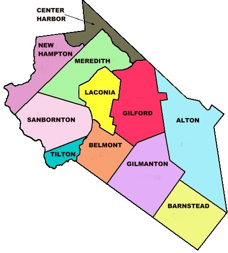
| To see a map of all sites click here. |
| ------ Anchorage, See: Philbrick (Reuben), T05-001 |
| T05-002 Bamford, off Route 3, USGS Northfield Quadrangle, E29446, N481623, Zone 19 (43° 28' 22"N, 71° 32' 28"W), Runnels #70. Source: Kim Sowles 1987 MAP |
| T05-005 Chase/Rundlett, Calef Hill Road, USGS Northfield Quadrangle, E28878, N481522, Zone 19 (43° 27' 43"N, 71° 36' 39"W), For an unknown reason this site was recorded as the Daniels Cemetery on the original Tilton list although there are no Daniels burials. Runnels #66. Source: Kim Sowles 1987 MAP |
| T05-010 Clark (Taylor), Pest House Road off Calef Hill Road, USGS Northfield Quadrangle, E28860, N481533, Zone 19 (43° 27' 47"N, 71° 36' 47"W), Runnels #67. Source: Kim Sowles 1987 MAP |
| T05-003 Clark Road Cemetery, Clark Road, USGS Northfield Quadrangle, E28880, N481393, Zone 19 (43° 27' 1.54"N, 71° 36' 36.61"W), (GPS: 43.4505017°N, 71.6096851°W), Runnels #65. Source: Kim Sowles 1987 MAP |
| T05-006 Gale, off School St. USGS Northfield Quadrangle, E29083, N481582, Zone 19 (43° 28' 5"N, 71° 35' 9"W), Runnels #72. Source: Kim Sowles 1987 MAP |
| ------ Grange Road, See: Union Bridge, T05-007 |
| T05-008 Lancaster Hill, Lancaster Hill Road, USGS Northfield Quadrangle, E29212, N481662, Zone 19 (43° 28' 32"N, 71° 34' 13"W), Runnels #68. Source: Kim Sowles 1987 MAP |
| ------ Lane (Joshua), See: Lancaster Hill, T05-008 |
| T05-009 Park Cemetery, West Main St. (Rte. 3), USGS Northfield Quadrangle, E28940, N481285, Zone 19 (43° 26' 27"N, 71° 36' 8"W), Runnels #73. Source: Kim Sowles 1987 MAP |
| ------ Pest House, See: Clark (Taylor), T05-010 |
| T05-004 Philbrick (Josiah), Main Street (Rte. 3), USGS Northfield Quadrangle, E29159, N481383, Zone 19 (43° 27' 1.11"N, 71° 34' 32.46"W), (GPS: 43.4503840°N, 71.5751996°W), This site was previously recorded as the Crawford Cemetery because it is located near the former Crawford residence. There are no Crawford burials. Runnels #71. Source: Kim Sowles 1987 MAP |
| T05-001 Philbrick (Reuben), Route 3, USGS Northfield Quadrangle, E29546, N481775, Zone 19 (43° 29' 12"N, 71° 31' 46"W), Those buried in this cemetery are mostly descendants of Reuben Philbrick and his second wife Elizabeth (Brown) Philbrick. Runnels #75. Source: Kim Sowles 1987 MAP |
| T05-012 Plains Cemetery, Route 3, USGS Northfield Quadrangle, E29319, N481483, Zone 19 (43° 27' 35.09"N, 71° 33' 22.71"W), (GPS: 43.4598229°N, 71.5558239°W), Source: Kim Sowles 1987 MAP |
| ------ Rundlett, See: Chase/Rundlett, T05-005 |
| ------ Sanborn Road, See: Lancaster Hill, T05-008 |
| T05-011 St. John, Route 132 (Sanborn Rd.), USGS Northfield Quadrangle, E29248, N481470, Zone 19 (43° 27' 30"N, 71° 33' 54"W), Source: Kim Sowles 1987 MAP |
| ------ Tilton "500", See: Plains Cemetery, T05-012 |
| ------ Tilton Highlands, See: Lancaster Hill, T05-008 |
| ------ Tin Corner, See: Clark Road Cemetery, T05-003 |
| T05-014 Trinity Memorial Garden, Main Street, USGS Northfield Quadrangle, E29037, N481297, Zone 19 (43° 26' 32"N, 71° 35' 25"W), Adjacent to the now closed Trinity Episcopal Church at 274 Main St. Source: Find a Grave 2022 MAP |
| T05-007 Union Bridge, Grange Road, USGS Northfield Quadrangle, E29449, N481731, Zone 19 (43° 28' 57"N, 71° 32' 28"W), Runnels #74. Source: Kim Sowles 1987 MAP |
Listings Copyright © 1998-2024 New Hampshire Old Graveyard Association.
All rights reserved.
Send mail to webmaster@nhoga.org with questions or comments about this web site.