In his 1882 History of Sanbornton Moses T. Runnels included a list of known cemeteries within the original bounds of Sanbornton, including the sections that became Tilton and parts of Franklin (Vol. 1, p. 308). The site IDs in this list are from Runnels' original Sanbornton numbering. By 1882 the sites #86 through #127 were already abandoned. With only two exceptions these sites contained only uninscribed fieldstone markers. Sites #128 through #134 are new since the 1882 list. In 2006 the Sanbornton Cemetery Committe resurveyed the list but many of the sites could not be located, particularly those abandoned prior to 1882. If you have the GPS coordinates for these, please send them along: Webmaster
| Burial Sites in Sanbornton, New Hampshire |
|---|
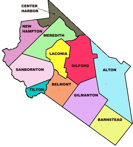
| To see a map of all sites click here. |
| S03-029 Abel Eastman, End of Oak Hill Road, (GPS: 43.5639000°N, 71.5656000°W), Tax map: 18 lot: 4-12, 18 graves Source: Sanbornton Cemetery Committee 2006, Lat./Long. from Googlemaps 2017 MAP |
| S03-042 Abrams, Flood Plane, (Coordinates needed) Note: Moved to Town of Hill. This occurred in 1941 when the Franklin Falls Dam was built as a flood control project. There are remnants of Old Hill Village. Evidently, it included a cemetery with no monuments. The "Abrams" graves are likely interred in a new cemetery in the new Hill village. (Original location unknown), Tax map: 13 lot: 21, 18 graves, Source: Sanbornton Cemetery Committee 2006, updated: Dean Dexter 2018 |
| S03-103 Aldrich Place, Near house site, (Location unknown), Not found, (Coordinates needed) Source: Sanbornton Cemetery Committee 2006 |
| S03-108 Arthur C. Taylor Farm, Ten Rods from site S03-032, (Location unknown), Not found, (Coordinates needed) Source: Sanbornton Cemetery Committee 2006 |
| S03-090 Bartlett K. Taylor Place, Rear of the buildings, (Location unknown), Not found, (Coordinates needed) Source: Sanbornton Cemetery Committee 2006 |
| ------ Batchelder, See: Charles S. Batchelder Farm, S03-115 |
| S03-021 Bay Baptist, 298 Upper Bay Road, USGS Winnisquam Lake Quadrangle, E29498, N482317, Zone 19 (43° 32' 7"N, 71° 32' 14"W), Tax map: 10 lot: 100, 34 graves Source: Sanbornton Cemetery Committee 2006 MAP |
| S03-047 Beckman/Eaton, 195 School House Road (Knox Mtn. Rd.), (GPS: 43.5264540°N, 71.6759610°W), Tax map: 7 lot: 14-1 Source: Sanbornton Cemetery Committee 2006, Lat./Long. from Googlemaps MAP |
| S03-101 Benjamin Calley Place, (Location unknown), Not found, (Coordinates needed) Source: Sanbornton Cemetery Committee 2006 |
| S03-076 Benjamin Philbrick, Corner of Chapman Rd. and Philbrook Road, USGS Winnisquam Lake Quadrangle, E29591, N481938, Zone 19 (43° 30' 5"N, 71° 31' 28"W), Source: Find a Grave 2022 MAP |
| S03-057 Brown, 800 ft. from Bridge on Mountain Rd, USGS Winnisquam Lake Quadrangle, E28822, N482358, Zone 19 (43° 32' 13"N, 71° 37' 16"W), Tax map: 8 lot: 94, 8 graves Source: Sanbornton Cemetery Committee 2006 MAP |
| ------ Brown, See: Ebenezer Brown Farm, S03-106 |
| ------ Bunker, See: David W. Bunker Farm, S03-092 |
| ------ Burleigh, See: William Burleigh, S03-001 |
| ------ Burley, See: Old DAR/Nathaniel Burley, S03-004a |
| ------ Burley, See: Josiah Burley, S03-063 |
| S03-002 Calef, Behind 207 Calef Hill Road, USGS Northfield Quadrangle, E28866, N481771, Zone 19 (43° 29' 4"N, 71° 36' 48"W), Tax map: 27 lot: 13, 17 graves Source: Sanbornton Cemetery Committee 2006 MAP |
| ------ Calef, See: Samuel P. Calef Place, S03-122 |
| ------ Calley, See: Benjamin Calley Place, S03-101 |
| S03-041 Cass, Under I-93 at exit 22, USGS Winnisquam Lake Quadrangle, E28855, N482028, Zone 19 (43° 30' 27"N, 71° 36' 57"W), Tax map: 21, 3 graves Source: Sanbornton Cemetery Committee 2006 MAP |
| S03-061 Caverly, Between 746 & 860 Route 132, USGS Winnisquam Lake Quadrangle, E28829, N482768, Zone 19 (43° 34' 26"N, 71° 37' 19"W), Tax map: 3 lot: 1, 5 graves Source: Sanbornton Cemetery Committee 2006 MAP |
| S03-086 Cawley Pasture, (Location unknown), Not found, (Coordinates needed) Source: Sanbornton Cemetery Committee 2006 |
| S03-055 Cawley Pond, 15 Hale Road and Route 132, USGS Winnisquam Lake Quadrangle, E28928, N482349, Zone 19 (43° 32' 12"N, 71° 36' 29"W), Tax map: 9 lot: 35, 40 graves Source: Sanbornton Cemetery Committee 2006 MAP |
| S03-053 Cawley/Swain, Hale Rd. East side - opp. 485, USGS Winnisquam Lake Quadrangle, E28902, N482352, Zone 19 (43° 32' 12"N, 71° 36' 40"W), Tax map: 9, 9 graves Source: Sanbornton Cemetery Committee 2006 MAP |
| ------ Cawly, See: Charles Cawly Farm, S03-107 |
| S03-007 Centre, Opp. 63/65 Tower Hill Road, USGS Northfield Quadrangle, E29100, N481933, Zone 19 (43° 29' 59"N, 71° 35' 6"W), Tax map: 22 lot: 38, 233 graves Source: Sanbornton Cemetery Committee 2006 MAP |
| S03-121 Centre Square (original), North of A.J.Sanborns, (Location unknown), Not found, (Coordinates needed) Source: Sanbornton Cemetery Committee 2006 |
| S03-039 Chapel/Chapman, Prescott Road - Golf Course Corner, USGS Franklin Quadrangle, E28715, N481936, Zone 19 (43° 29' 55.69"N, 71° 37' 57.58"W), (GPS: 43.4988380°N, 71.6321470°W), Tax map: 20 lot: 41, 32 graves Source: Sanbornton Cemetery Committee 2006 - updated: Karey Caldwell - 2018 MAP |
| ------ Chapman, See: Chapel/Chapman, S03-039 |
| S03-134 Chapman, Philbrook Road near #322, USGS Winnisquam Lake Quadrangle, E29609, N481954, Zone 19 (43° 30' 10.49"N, 71° 31' 20.14"W), (GPS: 43.5029876°N, 71.5217751°W), Three graves, only one marked Source: Sue Hunt 2022 MAP |
| S03-107 Charles Cawly Farm, Formerly Tilton Farm, (Location unknown), Not found, (Coordinates needed) Source: Sanbornton Cemetery Committee 2006 |
| S03-115 Charles S. Batchelder Farm, (Location unknown), Not found, (Coordinates needed) Source: Sanbornton Cemetery Committee 2006 |
| ------ Chase, See: Ebenezer Chase, S03-015 |
| S03-051 Chase Weeks, 200 yds past 104 Wadleigh Road, USGS Bristol Quadrangle, E28711, N482182, Zone 19 (43° 31' 15"N, 71° 38' 3"W), Tax map: 14 lot: 8, 14 graves Source: Sanbornton Cemetery Committee 2006 MAP |
| S03-025 Christopher Sanborn, 299 Woodman Road, (GPS: 43.5473270°N, 71.5628410°W), Tax map: 4 lot: 44, 7 graves Source: Sanbornton Cemetery Committee 2006, Lat./Long. from Googlemaps 2017 MAP |
| S03-026 Clark, Woodman Rd. North Side (Gone?), (Location unknown), Not found, Tax map: 4, 26 graves, (Coordinates needed) Source: Sanbornton Cemetery Committee 2006 |
| ------ Clark, See: Joseph S. Clark Place, S03-113 |
| S03-105 Clark's Corner, Southeast of old Clark House, (Location unknown), Not found, 3 graves, (Coordinates needed) Source: Sanbornton Cemetery Committee 2006 |
| S03-011 Colby, Past 79 Colby Road on right, USGS Winnisquam Lake Quadrangle, E29274, N482040, Zone 19 (43° 30' 35"N, 71° 33' 50"W), Tax map: 16 lot: 31, 10 graves Source: Sanbornton Cemetery Committee 2006 MAP |
| ------ Colby, See: Ebenezer Colby Farm, S03-119 |
| S03-078 Cram's Corner, Philbrook Road near intersetion of Cram Road, USGS Northfield Quadrangle, E29414, N481844, Zone 19 (43° 29' 33"N, 71° 32' 45"W), Source: Sanbornton Cemetery Committee 2006 MAP |
| S03-048 Curtis Weeks, 267 Osgood Road, (GPS: 43.5128340°N, 71.6513930°W), Tax map: 14 lot: 42 Source: Sanbornton Cemetery Committee 2006, Lat./Long. from Googlemaps 2017 MAP |
| S03-132 Cutillo Burial Ground, Past Steele Hill Resort in Left Field, USGS Winnisquam Lake Quadrangle, E29211, N482545, Zone 19 (43° 33' 18"N, 71° 34' 25"W), Tax map: 4 lot: 63, 1 graves Source: Sanbornton Cemetery Committee 2006 MAP |
| ------ DAR, See: Old DAR/Nathaniel Burley, S03-004a |
| S03-009 David Hunkins, Behind 249 Hunkins Pond Road, USGS Winnisquam Lake Quadrangle, E29230, N481933, Zone 19 (43° 29' 59.93"N, 71° 34' 8.45"W), (GPS: 43.5000551°N, 71.5685301°W), Tax map: 13 lot: 9, 9 graves Source: Sanbornton Cemetery Committee 2006, Lat/Long updated/corrected 2017 by webmaster MAP |
| S03-037 David L. Morrison, 149 Burleigh Hill Road (in field), USGS Northfield Quadrangle, E28843, N481821, Zone 19 (43° 29' 20"N, 71° 36' 59"W), Tax map: 21 lot: 50 Source: Sanbornton Cemetery Committee 2006 MAP |
| S03-092 David W. Bunker Farm, (Location unknown), Not found, (Coordinates needed) Source: Sanbornton Cemetery Committee 2006 |
| ------ Dearborn, See: Phineas Dearborn, S03-013 |
| ------ Dearborn, See: Josiah Dearborn, S03-058 |
| S03-019 Doe/Ford, Between 305 and 343 Lower Bay Road, USGS Winnisquam Lake Quadrangle, E29634, N482229, Zone 19 (43° 31' 40"N, 71° 31' 13"W), Tax map: 12 lot: 97, 43 graves Source: Sanbornton Cemetery Committee 2006 MAP |
| S03-095 Dudley Farm, (Location unknown), Not found, (Coordinates needed) Source: Sanbornton Cemetery Committee 2006 |
| S03-052 Dustin, Brook Road, USGS Bristol Quadrangle, E28765, N482111, Zone 19 (43° 30' 52.87"N, 71° 37' 37.80"W), (GPS: 43.5147720°N, 71.6266630°W), Tax map: 15 lot: 47, 12 graves Source: Sanbornton Cemetery Committee 2006; Lat/Long Corrected 2018 by Karey Caldwell MAP |
| S03-131 Dyment Burial Ground, 946 Route 127, (GPS: 43.5055480°N, 71.6145720°W), Tax map: 15 lot: 61-2a, 1 graves Source: Sanbornton Cemetery Committee 2006, Lat/Long updated by webmaster 2017 MAP |
| ------ Eastman, See: Abel Eastman, S03-029 |
| ------ Eaton, See: Beckman/Eaton, S03-047 |
| S03-106 Ebenezer Brown Farm, (Location unknown), (Coordinates needed) Source: Sanbornton Cemetery Committee 2006 |
| S03-015 Ebenezer Chase, 693 Hunkins Pond Road (Gone?), (GPS: 43.5148340°N, 71.5411000°W), Tax map: 16 lot: 62, 5 graves Source: Sanbornton Cemetery Committee 2006 Lat./Long. from Googlemaps 2017 MAP |
| S03-119 Ebenezer Colby Farm, North of Otis S. Sanborns, (Location unknown), Not found, (Coordinates needed) Source: Sanbornton Cemetery Committee 2006, |
| S03-077 Ebenezer Sanborn and David Philbrook, Philbrook Road (between #88 and #184), USGS Northfield Quadrangle, E29483, N481878, Zone 19 (43° 29' 45"N, 71° 32' 15"W), Tax map: 23 lot: 44, 35 graves Source: Sanbornton Cemetery Committee 2006 MAP |
| ------ Edgerly, See: Jonathan Edgerly Place, S03-111 |
| S03-088 Emerson Farm, (Location unknown), Not found, (Coordinates needed) Source: Sanbornton Cemetery Committee 2006 |
| S03-089 Emerson Farm, Opposite site S03-088, (Location unknown), Not found, (Coordinates needed) Source: Sanbornton Cemetery Committee 2006 |
| S03-060 Farnham, 680 Route 132. Behind Store, USGS Winnisquam Lake Quadrangle, E28866, N482661, Zone 19 (43° 33' 52"N, 71° 37' 1"W), Tax map: 3 lot: 49-3, 7 graves Source: Sanbornton Cemetery Committee 2006 MAP |
| S03-036 First Baptist, Between 946/976 Route 127, (GPS: 43.5054230°N, 71.6146565°W), Tax map: 15 lot: 61-29, 115 graves Source: Sanbornton Cemetery Committee 2006, Lat./Long. from Googlemaps 2017 MAP |
| S03-125 First Baptist Meeting House, East of Charles B. Perley's, (Location unknown), Not found, (Coordinates needed) Source: Sanbornton Cemetery Committee 2006 |
| ------ Ford, See: Doe/Ford, S03-019 |
| ------ Ford, See: William Ford Place, S03-117 |
| S03-059 George, Off Old Mountain Road 1/2 Mile, USGS Winnisquam Lake Quadrangle, E28830, N482590, Zone 19 (43° 33' 29"N, 71° 37' 16"W), Tax map: 8 lot: 96, 8 graves Source: Sanbornton Cemetery Committee 2006 MAP |
| S03-033 Giles, 209 Route 132, on Isaac Colby Road, USGS Winnisquam Lake Quadrangle, E28993, N482373, Zone 19 (43° 32' 20"N, 71° 35' 60"W), Tax map: 9 lot: 76, 5 graves Source: Sanbornton Cemetery Committee 2006 MAP |
| ------ Gilman, See: Moses Gilman, S03-016 |
| ------ Gilman, See: Jeremiah Gilman, S03-017 |
| S03-129 Giunta Burial Ground, 65 Tower Hill Road, (GPS: 43.4989380°N, 71.5841800°W), Tax map: 22 lot: 19-3, 2 graves Source: Sanbornton Cemetery Committee 2006, Lat./Long. from Googlemaps 2017 MAP |
| S03-006 Hersey, In field behind 91 March Road, USGS Northfield Quadrangle, E28954, N481704, Zone 19 (43° 28' 43"N, 71° 36' 8"W), Tax map: 27 lot: 28-2, 29 graves Source: Sanbornton Cemetery Committee 2006 MAP |
| ------ Hunkins, See: David Hunkins, S03-009 |
| ------ Hunkins, See: Robert Hunkins, S03-010 |
| S03-022 Huse, Opposite 662 Lower Bay Rd. on Huse Road, USGS Winnisquam Lake Quadrangle, E29636, N482231, Zone 19 (43° 31' 40"N, 71° 31' 12"W), Tax map: 10 lot: 49, 6 graves Source: Sanbornton Cemetery Committee 2006 MAP |
| S03-126 Jeremiah B. Osgood Farm, (Location unknown), Not found, (Coordinates needed) Source: Sanbornton Cemetery Committee 2006 |
| S03-017 Jeremiah Gilman, 273 Philbrook Road;Opp. #270, USGS Winnisquam Lake Quadrangle, E29562, N481940, Zone 19 (43° 30' 5"N, 71° 31' 41"W), Tax map: 24 lot: 4, 25 graves Source: Sanbornton Cemetery Committee 2006 MAP |
| S03-123 John Perkins Farm, Old Road SE of dwelling in Tilton, (Location unknown), Not found, (Coordinates needed) Source: Sanbornton Cemetery Committee 2006 |
| S03-116 John Woodman Farm, North of Ira Woodman.Transfer-24, (Location unknown), Not found, (Coordinates needed) Source: Sanbornton Cemetery Committee 2006 |
| S03-111 Jonathan Edgerly Place, (Location unknown), Not found, (Coordinates needed) Source: Sanbornton Cemetery Committee 2006 |
| S03-027 Jonathan Morrison, 403, Woodman Road, USGS Winnisquam Lake Quadrangle, E29299, N482428, Zone 19 (43° 32' 41"N, 71° 33' 45"W), Tax map: 10 lot: 18, 20 graves Source: Sanbornton Cemetery Committee 2006 MAP |
| S03-020 Jonathan R. Sanborn, 38 Collieson Road. (Gone?), (GPS: 43.5303840°N, 71.5304550°W), Tax map: 10 lot: 118 Source: Sanbornton Cemetery Committee 2006; Lat./Long. from Googlemaps 2017 MAP |
| S03-030 Joseph Leavitt, Past Steele Hill Resort in Left Field, USGS Winnisquam Lake Quadrangle, E29211, N482545, Zone 19 (43° 33' 18"N, 71° 34' 25"W), Tax map: 4 lot: 63, 13 graves Source: Sanbornton Cemetery Committee 2006 MAP |
| S03-100 Joseph Mason Farm, 267 Osgood Road in Field, (GPS: 43.5128340°N, 71.6513930°W), No records Source: Sanbornton Cemetery Committee 2006, Lat./Long. from Googlemaps 2017 MAP |
| S03-012 Joseph Philbrook, North of Old Range Road, USGS Winnisquam Lake Quadrangle, E29063, N482005, Zone 19 (43° 30' 21.57"N, 71° 35' 23.74"W), (GPS: 43.5060657°N, 71.5894429°W), Tax map: 16 lot: 17, 12 graves Source: Sanbornton Cemetery Committee 2006, Lat./Long. from Googlemaps 2017 MAP |
| S03-113 Joseph S. Clark Place, North of William H Eastmans, (Location unknown), Not found, (Coordinates needed) Source: Sanbornton Cemetery Committee 2006 |
| S03-063 Josiah Burley, Opposite 215 Eastman Hill Road, USGS Winnisquam Lake Quadrangle, E29110, N482507, Zone 19 (43° 33' 5"N, 71° 35' 10"W), Tax map: 9 lot: 12, 10 graves Source: Sanbornton Cemetery Committee 2006 MAP |
| S03-058 Josiah Dearborn, West of Mountain Rd . (Location unknown), 12 graves, (Coordinates needed) Source: Sanbornton Cemetery Committee 2006 |
| S03-040 Josiah Sanborn, 531 New Hampton Road, USGS Franklin Quadrangle, E28667, N481859, Zone 19 (43° 29' 30"N, 71° 38' 18"W), Tax map: 25 lot: 10, 10 graves Source: Sanbornton Cemetery Committee 2006 MAP |
| S03-118 Josiah Sanborn Farm, Near the present Smith Neal's, (Location unknown), Not found, (Coordinates needed) Source: Sanbornton Cemetery Committee 2006 |
| S03-079 Josiah Sanborn and Elisha Lougee, Perkins Road between #226 and #272, USGS Northfield Quadrangle, E29291, N481799, Zone 19 (43° 29' 17.15"N, 71° 33' 39.48"W), (GPS: 43.4881707°N, 71.5604825°W), Source: Sanbornton Cemetery Committee 2006 MAP |
| S03-049 Jotham Rollins, Osgood Road - on south side, USGS Bristol Quadrangle, E28557, N482118, Zone 19 (43° 30' 53"N, 71° 39' 10"W), Tax map: 20 lot: 14, 7 graves Source: Sanbornton Cemetery Committee 2006 MAP |
| S03-124 Kelley Ledge (southeast), North of William Payne's, (Location unknown), Not found, (Coordinates needed) Source: Sanbornton Cemetery Committee 2006 |
| S03-054 Lane, 270 ft East of 203 Hale Road, USGS Winnisquam Lake Quadrangle, E28838, N482355, Zone 19 (43° 32' 12.62"N, 71° 37' 8.74"W), (GPS: 43.5369135°N, 71.6186105°W), Tax map: 14 lot: 12-4, 28 graves Source: Sanbornton Cemetery Committee 2006, Lat./Long. from Googlemaps 2017 MAP |
| S03-098 Late Elias Russell Place, rear of Buildings, (Location unknown), No records, (Coordinates needed) Source: Sanbornton Cemetery Committee 2006 |
| ------ Leavitt, See: Moses Leavitt, S03-018 |
| ------ Leavitt, See: Joseph Leavitt, S03-030 |
| ------ Lougee, See: Josiah Sanborn and Elisha Lougee, S03-079 |
| S03-005 March, 200 March Road, USGS Northfield Quadrangle, E28909, N481707, Zone 19 (43° 28' 44"N, 71° 36' 28"W), Tax map: 27 lot: 18, 36 graves Source: Sanbornton Cemetery Committee 2006 MAP |
| ------ Mason, See: Joseph Mason Farm, S03-100 |
| ------ Mason, See: William B. Mason's, S03-102 |
| S03-003 Matthew Thompson, Behind 274 Calef Hill Road, USGS Northfield Quadrangle, E28849, N481709, Zone 19 (43° 28' 44"N, 71° 36' 55"W), Tax map: 27 lot: 17, 5 graves Source: Sanbornton Cemetery Committee 2006 MAP |
| S03-087 McClary Place, On Sanbornton Mountain, (Location unknown), No records, (Coordinates needed) Source: Sanbornton Cemetery Committee 2006 |
| ------ Moore, See: William Moore Place, S03-120 |
| S03-064 Morrill/Shaw, Flood Plane, now in Franklin Cem. F05-001, USGS Winnisquam Lake Quadrangle, (Coordinates needed) (Location unknown), Tax map: 20 lot: 13-21, 24 graves Source: Sanbornton Cemetery Committee 2006 |
| ------ Morrison, See: Jonathan Morrison, S03-027 |
| ------ Morrison, See: David L. Morrison, S03-037 |
| ------ Morrison, See: Simon R. Morrison Farm, S03-112 |
| S03-016 Moses Gilman, East of 111 Upper Smith Road, USGS Winnisquam Lake Quadrangle, E29662, N482122, Zone 19 (43° 31' 5"N, 71° 30' 59"W), Tax map: 17 lot: 63, 27 graves Source: Sanbornton Cemetery Committee 2006 MAP |
| S03-018 Moses Leavitt, Behind 35 Leavitt Road, USGS Winnisquam Lake Quadrangle, E29591, N482166, Zone 19 (43° 31' 19"N, 71° 31' 31"W), Tax map: 16 lot: 51, 20 graves Source: Sanbornton Cemetery Committee 2006 MAP |
| S03-004 Moses Thompson, Behind 307 Calef Hill Road, USGS Northfield Quadrangle, E28779, N481679, Zone 19 (43° 28' 33"N, 71° 37' 26"W), Tax map: 27 lot: 9, 14 graves Source: Sanbornton Cemetery Committee 2006 MAP |
| S03-024 New Bay, Opposite from 79 Woodman Road, USGS Winnisquam Lake Quadrangle, E29430, N482399, Zone 19 (43° 32' 33"N, 71° 32' 46"W), Tax map: 10 lot: 44-2, 211 graves Source: Sanbornton Cemetery Committee 2006 MAP |
| S03-046 Newton, Knox Mtn. Road - on West side, (Location unknown), Not found, Tax map: 13 lot: 18-1, (Coordinates needed) Source: Sanbornton Cemetery Committee 2006 |
| S03-056 North Sanbornton, East of 24 Hermit Woods Road, USGS Winnisquam Lake Quadrangle, E28934, N482530, Zone 19 (43° 33' 10"N, 71° 36' 28"W), Tax map: 8 lot: 25, 53 graves Source: Sanbornton Cemetery Committee 2006 MAP |
| S03-128 Nudd Burial Ground, 145 March Road, USGS Northfield Quadrangle, E28935, N481667, Zone 19 (43° 28' 31"N, 71° 36' 16"W), Tax map: 27 lot: 28-2, 2 graves Source: Sanbornton Cemetery Committee 2006 MAP |
| S03-023 Odell, Past 309 Roxbury Road. (Gone?), (GPS: 43.5615600°N, 71.5501240°W), Tax map: 4 lot: 47 Source: Sanbornton Cemetery Committee 2006, Lat./Long. from Googlemaps 2017 MAP |
| S03-004a Old DAR/Nathaniel Burley, Next to 377 Calef Hill Road, USGS Northfield Quadrangle, E28769, N481636, Zone 19 (43° 28' 19.10"N, 71° 37' 29.35"W), (GPS: 43.4720453°N, 71.6243357°W), Tax map: 27 lot: 7, 7 graves Source: Sanbornton Cemetery Committee 2006, Lat./Long. from Googlemaps 2017 MAP |
| S03-93M Old Plummer Graveyard, Past 116 Plummer Road.(Meredith), USGS Winnisquam Lake Quadrangle, E29060, N482725, Zone 19 (43° 34' 14.69"N, 71° 35' 35.06"W), (GPS: 43.5708207°N, 71.5925898°W), Tax map: 4 lot: 1, 15 graves Source: Sanbornton Cemetery Committee 2006, Lat./Long. from Googlemaps 2017 MAP |
| S03-114 Old Town's Farm, 255 Woodman Road, (GPS: 43.5500020°N, 71.5622640°W), Tax map: 4 lot: 45 Source: Sanbornton Cemetery Committee 2006, Lat./Long. from Googlemaps 2017 MAP |
| S03-045 Osgood, Opposite 170 Knox Mountain Road, USGS Bristol Quadrangle, E28480, N482132, Zone 19 (43° 30' 57"N, 71° 39' 45"W), Tax map: 20 lot: 3, 10 graves Source: Sanbornton Cemetery Committee 2006 MAP |
| ------ Osgood, See: Jeremiah B. Osgood Farm, S03-126 |
| S03-127 Pasture, Northeast of Ebenezer Burleigh's, (Location unknown), Not found, (Coordinates needed) Source: Sanbornton Cemetery Committee 2006 |
| S03-008 Perkins, Left of 158 Hunkins Pond Road, (GPS: 43.5000130°N, 71.5691210°W), Tax map: 23 lot: 2, 11 graves Source: Sanbornton Cemetery Committee 2006, Lat./Long. from Googlemaps 2017 MAP |
| ------ Perkins, See: John Perkins Farm, S03-123 |
| ------ Philbrick, See: Benjamin Philbrick, S03-076 |
| ------ Philbrook, See: Joseph Philbrook, S03-012 |
| ------ Philbrook, See: Ebenezer Sanborn and David Philbrook, S03-077 |
| S03-013 Phineas Dearborn, Behind 105 Dearborn Road, USGS Winnisquam Lake Quadrangle, E29323, N482083, Zone 19 (43° 30' 49"N, 71° 33' 29"W), Tax map: 16 lot: 36, 5 graves Source: Sanbornton Cemetery Committee 2006 MAP |
| S03-050 Piper, Brook Road and Wadleigh Road, USGS Bristol Quadrangle, E28779, N482120, Zone 19 (43° 30' 56"N, 71° 37' 32"W), Tax map: 20 lot: 24, 53 graves Source: Sanbornton Cemetery Committee 2006 MAP |
| S03-133 Piscopo Burial Grounds, 359 Hunkins Pond Road, (GPS: 43.5065640°N, 71.5573380°W), Tax map: 23 lot: 14 Source: Sanbornton Cemetery Committee 2006, Lat./Long. from Googlemaps 2017 MAP |
| S03-062 Plumer, 15 Plumer Road (Opposite from 26), USGS Winnisquam Lake Quadrangle, E29063, N482639, Zone 19 (43° 33' 47"N, 71° 35' 33"W), Tax map: 4 lot: 5-2, 11 graves Source: Sanbornton Cemetery Committee 2006 MAP |
| ------ Plumer, See: Stephen Plumer Place, S03-093 |
| ------ Plummer, See: Old Plummer Graveyard, S03-93M |
| S03-043 Prescott, Opp. 363 Knox Mountain Road, USGS Bristol Quadrangle, E28374, N482334, Zone 19 (43° 32' 1"N, 71° 40' 35"W), Tax map: 13 lot: 10, 71 graves Source: Sanbornton Cemetery Committee 2006 MAP |
| S03-104 Prescott Farm, North of Harrison White's, (Location unknown), Not found, (Coordinates needed) Source: Sanbornton Cemetery Committee 2006 |
| S03-094 Quimby Farm, (Location unknown), Not found, (Coordinates needed) Source: Sanbornton Cemetery Committee 2006 |
| S03-010 Robert Hunkins, Next to 384 Hunkins Pond Road, USGS Winnisquam Lake Quadrangle, E29363, N482019, Zone 19 (43° 30' 29"N, 71° 33' 10"W), Tax map: 16 lot: 38, 24 graves Source: Sanbornton Cemetery Committee 2006 MAP |
| ------ Rollins, See: Rueben Rollins, S03-035 |
| ------ Rollins, See: Jotham Rollins, S03-049 |
| S03-035 Rueben Rollins, 1226 New Hampton Rd. - Rte 127, (GPS: 43.5184130°N, 71.6080400°W), Tax map: 15 lot: 45, 5 graves Source: Sanbornton Cemetery Committee 2006, Lat./Long. from Googlemaps 2017 MAP |
| ------ Russell, See: Late Elias Russell Place, S03-098 |
| S03-122 Samuel P. Calef Place, Adjacent to Blacksmith's shop. Formerly a tomb on this site. Removed prior to 1882, moved to S03-007, (Location unknown), Not found, (Coordinates needed) Source: Sanbornton Cemetery Committee 2006 |
| S03-109 Samuel Taylor Farm, east of dwelling, (Location unknown), Not found, (Coordinates needed) Source: Sanbornton Cemetery Committee 2006 |
| ------ Sanborn, See: Jonathan R. Sanborn, S03-020 |
| ------ Sanborn, See: Christopher Sanborn, S03-025 |
| ------ Sanborn, See: Josiah Sanborn, S03-040 |
| ------ Sanborn, See: Josiah Sanborn Farm, S03-118 |
| ------ Sanborn/Lougee, See: Josiah Sanborn and Elisha Lougee, S03-079 |
| ------ Sanborn/Philbrook, See: Ebenezer Sanborn and David Philbrook, S03-077 |
| S03-028 Sanders, 217 Steele Hill Rd. Right of Drive, (GPS: 43.5393420°N, 71.5564810°W), Tax map: 10 lot: 54, 2 graves Source: Sanbornton Cemetery Committee 2006, Lat./Long. from Googlemaps 2017 MAP |
| S03-099 School House Site, Near but separate from S03-052, (Location unknown), Not found, (Coordinates needed) Source: Sanbornton Cemetery Committee 2006 |
| S03-130 Shadagee Mountain Burial Ground, Opposite 150 Hale Road, (GPS: 43.5383480°N, 71.6247250°W), Tax map: 9, 1 graves Source: Sanbornton Cemetery Committee 2006, Lat./Long. from Googlemaps 2017 MAP |
| ------ Shaw, See: Morrill/Shaw, S03-064 |
| S03-034 Shute, 800 ft on Shute Hill Extension, USGS Winnisquam Lake Quadrangle, E28480, N482131, Zone 19 (43° 30' 56"N, 71° 39' 45"W), Tax map: 15 lot: 29, 84 graves Source: Sanbornton Cemetery Committee 2006 MAP |
| S03-112 Simon R. Morrison Farm, Rear of Barn, (Location unknown), Not found, (Coordinates needed) Source: Sanbornton Cemetery Committee 2006 |
| S03-038 Smith, 98 Burleigh Hill Road, (GPS: 43.4975070°N, 71.6155750°W), Tax map: 21 lot: 72, 3 graves Source: Sanbornton Cemetery Committee 2006, Lat./Long. from Googlemaps 2017 MAP |
| ------ Smith, See: Timothy Smith Place, S03-110 |
| S03-031 Steele, Near 518 Steel Hill Road, USGS Winnisquam Lake Quadrangle, E29210, N482488, Zone 19 (43° 32' 59"N, 71° 34' 25"W), Tax map: 4 lot: 63, 2 graves Source: Sanbornton Cemetery Committee 2006 MAP |
| S03-093 Stephen Plumer Place, Opposite 26 Plummer Road, USGS Winnisquam Lake Quadrangle, E29043, N482713, Zone 19 (43° 34' 11"N, 71° 35' 42"W), Tax map: 4 lot: 4-2, 5 graves Source: Sanbornton Cemetery Committee 2006 MAP |
| S03-044 Swain, Opposite 266 Knox Mountain Road. USGS Bristol Quadrangle, E28425, N482170, Zone 19 (43° 31' 8"N, 71° 40' 10"W), Tax map: 14 lot: 1, 6 graves Source: Sanbornton Cemetery Committee 2006 MAP |
| ------ Swain, See: Cawley/Swain, S03-053 |
| S03-032 Taylor, East of 27 Taylor Road, USGS Winnisquam Lake Quadrangle, E29153, N482408, Zone 19 (43° 32' 33"N, 71° 34' 49"W), Tax map: 10 lot: 38, 13 graves Source: Sanbornton Cemetery Committee 2006 MAP |
| ------ Taylor, See: Bartlett K. Taylor Place, S03-090 |
| ------ Taylor, See: Arthur C. Taylor Farm, S03-108 |
| ------ Taylor, See: Samuel Taylor Farm, S03-109 |
| S03-091 Thomas Webster Place, Near the buildings, (Location unknown), Not found, (Coordinates needed) Source: Sanbornton Cemetery Committee 2006 |
| ------ Thompson, See: Matthew Thompson, S03-003 |
| ------ Thompson, See: Moses Thompson, S03-004 |
| S03-110 Timothy Smith Place, West of Obadiah Eastman's, (Location unknown), Not found, (Coordinates needed) Source: Sanbornton Cemetery Committee 2006 |
| ------ Town Farm, See: Old Town's Farm, S03-114 |
| S03-TPC Town Public Cemetery, Opposite 192 Tower Hill Road, USGS Northfield Quadrangle, E29079, N482040, Zone 19 (43° 30' 33"N, 71° 35' 17"W), Tax map: 15 lot: 101 Source: Sanbornton Cemetery Committee 2006 MAP |
| S03-096 Unknown, Between Dudley & North Sanborn, On land between 95 & North Sanbornton village, (Location unknown), Not found, (Coordinates needed) Source: Sanbornton Cemetery Committee 2006 |
| S03-097 Wadleigh Farm, Old Tilton Bridge Rd. Median of I-93, (GPS: 43.4532500°N, 71.5707810°W), Source: Sanbornton Cemetery Committee 2006, Lat./Long. from Googlemaps 2017 MAP |
| S03-014 Wallis, West of 606 Hunkins Pond Road, USGS Winnisquam Lake Quadrangle, E29458, N482092, Zone 19 (43° 30' 54"N, 71° 32' 29"W), Tax map: 16 lot: 43-0, 20 graves Source: Sanbornton Cemetery Committee 2006 MAP |
| ------ Webster, See: Thomas Webster Place, S03-091 |
| ------ Weeks, See: Curtis Weeks, S03-048 |
| ------ Weeks, See: Chase Weeks, S03-051 |
| S03-102 William B. Mason's, Opposite side of highway from former Mason residence, (Location unknown), Not found, (Coordinates needed) Source: Sanbornton Cemetery Committee 2006 |
| S03-001 William Burleigh, Next to 226 Burleigh Hill Road, USGS Northfield Quadrangle, E28871, N481767, Zone 19 (43° 29' 3"N, 71° 36' 46"W), Tax map: 21 lot: 61, 24 graves Source: Sanbornton Cemetery Committee 2006 MAP |
| S03-117 William Ford Place, Formerly Oliver Calef place, (Location unknown), Not found, (Coordinates needed) Source: Sanbornton Cemetery Committee 2006 |
| S03-120 William Moore Place, North side of road, (Location unknown), Not found, (Coordinates needed) Source: Sanbornton Cemetery Committee 2006 |
| ------ Woodman, See: John Woodman Farm, S03-116 |
Listings Copyright © 1998-2024 New Hampshire Old Graveyard Association.
All rights reserved.
Send mail to webmaster@nhoga.org with questions or comments about this web site.