Additional information about Eaton cemeteries can be found as part of the Brownfield, ME Cemeteries web site.
| Burial Sites in Eaton, New Hampshire |
|---|
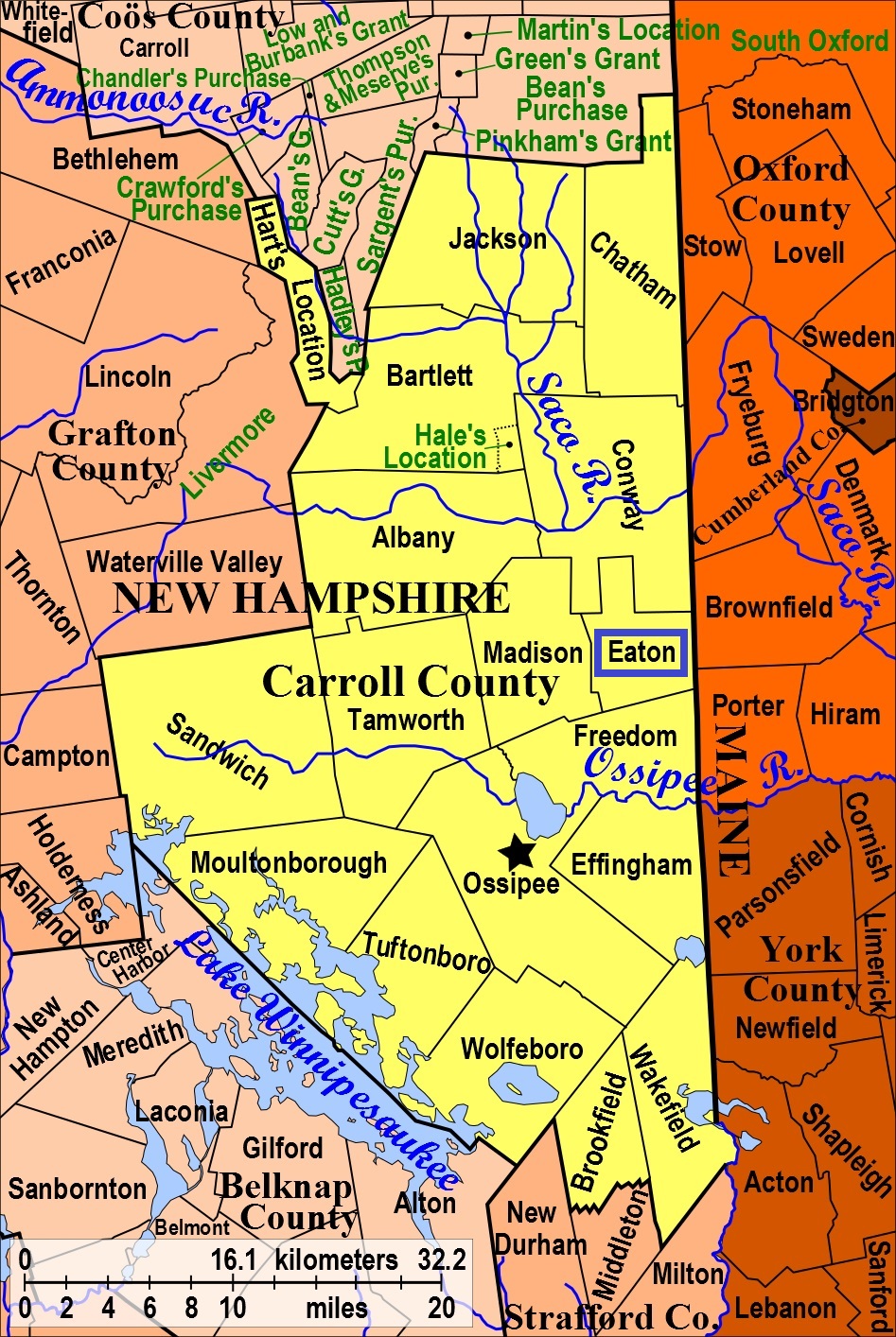
| To see a map of all sites click here. |
| ------ Adams/Drew, See: Drew/Kenneson, E03-014 |
| ------ Allard, See: Allard, F06-019 in Freedom. , This site is actually in Freedom although access is from the Eaton side only. |
| E03-027 Allen, North of Towle Hill Road, USGS Freedom Quadrangle, E33450, N485925, Zone 19 (43° 52' 11.02"N, 71° 3' 34.84"W), (GPS: 43.8698200°N, 71.0591800°W), Directions: The historic Job Allard house is on the north side of the intersection of Towle Hill Road and Hampton Lane. An old road leaves Towle Hill Road on the left (west) side of the barn. Follow this old road north 0.2 miles to a log bridge over Stony Brook. Continue north on the old road 0.37 miles until a cellar hole on the left (west) side. The small stone-walled cemetery is 100 yards northeast from the cellar. Source: Ann Donahue, 1993, updated: Jess Davis 2020 MAP |
| E03-013 Bachelder, North side of Brownfield Road, 0.5 miles east of route 153, USGS Conway Quadrangle, E33421, N486417, Zone 19 (43° 54' 50.16"N, 71° 3' 53.33"W), (GPS: 43.9140200°N, 71.0643600°W), Directions: From its intersection with Route 153, drive east on Brownfield Road 0.5 miles (past the Town Hall). Turn left (north) onto a driveway (Fire Lane 33) and drive 150 yards to the first house. The small stone-walled cemetery is 50 yards further north in the house's backyard. Source: Ann Donahue, 1993, updated: Jess Davis 2020 MAP |
| ------ Bean (Howard), See: Littlefield/Bean, E03-023 |
| ------ Birch Hill, See: Littlefield/Bean, E03-023 |
| ------ Blossom Place, See: Keith, E03-029 |
| E03-006 Brooks (John), Southwest side of Foss Moutain Road, 1.25 miles from Stewart Road, USGS Conway Quadrangle, E33601, N486102, Zone 19 (43° 53' 9.57"N, 71° 2' 29.19"W), (GPS: 43.8860600°N, 71.0409300°W), Listed as being in Brooks Pasture on old listing. Directions: From its intersection with Stewart Road, drive southeast on Foss Mountain Road 1.25 miles to the Foss Mountain trailhead. Follow the trail west 800 feet to a cellar hole and sign on the right (north). The stone-walled cemetery is 250 feet to the north. Source: Ann Donahue, 1993, updated: Jess Davis 2020 MAP |
| E03-042 Brooks (Samuel), North side of Foss Mountain Road, USGS Conway Quadrangle, E33691, N486021, Zone 19 (43° 52' 44.05"N, 71° 1' 47.99"W), (GPS: 43.8789600°N, 71.0295600°W), Directions: From its intersection with Stewart Road, drive southeast on Foss Mountain Road 1.9 miles to a cabin on the northeast side of the road. With permission, walk 200 feet east to a small, empty, stone-walled cemetery Source: Jess Davis 2020 MAP |
| ------ Brooks (William), See: Currier/Wilkinson/Manson, E03-024 |
| E03-024 Currier/Wilkinson/Manson, West side of Paul Hill Road, 0.7 miles north of Towle Hill Road. USGS Freedom Quadrangle, E33578, N485934, Zone 19 (43° 52' 14.97"N, 71° 2' 37.63"W), (GPS: 43.8708500°N, 71.0433400°W), Directions: From its intersection with Towle Hill Road, drive north and west on Currier Road/Paul Hill Road for close to 0.7 miles. On the left (west) side is a cellar in a pasture. The cemetery is 200 feet west along the north edge of the pasture. This larger multi-family cemetery is surrounded by a stone wall. The back (west) section is surrounded by split granite slabs. Note: The northern part of Paul Hill Road is not maintained for winter travel. Google Maps lists the Freedom portion of Currier Road/Paul Hill Road as Willis Bean Road. Source: Ann Donahue, 1993, updated: Jess Davis 2020 MAP |
| E03-043 Davis, Peddlar's End Lane, six tenths of a mile east of Peddlar's End, USGS Freedom Quadrangle, E33857, N485962, Zone 19 (43° 52' 26.25"N, 71° 0' 33.01"W), (GPS: 43.8740300°N, 71.0086900°W), Directions: From its intersection with Stewart Road, drive south and east on Foss Mountain Road 1.4 miles. Turn right (south) onto Willis Bean Road and follow it 0.3 miles to gated Peddler's End Lane. With permission, follow this lane east past the house and into the woods for almost 0.6 miles to a stone wall. Follow the stone wall north 400 feet. The cemetery is in the corner of the stone wall, surrounded by stone wall on the other two sides. There are only fieldstones, no carved headstones, in this small family cemetery. Note: Most of this route is not maintained for winter travel Source: Jess Davis 2020 MAP |
| ------ Demerett, See: Currier/Wilkinson/Manson, E03-024 |
| ------ Dolloff, See: Dolloff, C19-029 in Conway. , Just over the Conway town line |
| ------ Drew, See: Sawyer/Drew, E03-015 |
| ------ Drew (Solomon), See: Drew/Kenneson, E03-014 |
| E03-014 Drew/Kenneson, West side of Stewart Road, 0.5 miles south of Brownfield Road, USGS Conway Quadrangle, E33475, N486304, Zone 19 (43° 54' 13.99"N, 71° 3' 27.88"W), (GPS: 43.9039200°N, 71.0572500°W), Directions: From its intersection with Brownfield Road, drive south on Stewart Road 0.5 miles to a house on the right (west) side of the road. Park and follow a stone-wall lined path west from the house. Take a left at the fork in the wall and walk uphill to the south. The cemetery is surrounded by a stone wall and has a split granite post and lintel entrance. (Also known as Adams/Drew Cemetery although there are no Adams family members buried here) Source: Ann Donahue, 1993, updated: Jess Davis 2020 MAP |
| E03-019 Drew/Littlefield, Stewart Road (North side, northwest of Brockhirst Farm), USGS Conway Quadrangle, E33755, N486258, Zone 19 (43° 54' 1"N, 71° 1' 22"W), Remaining stones have initials only Source: Ann Donahue, 1993 MAP |
| ------ Durgin, See: Currier/Wilkinson/Manson, E03-024 |
| E03-031 Durgin, West side of Sunset Beach Road, 0.35 miles north of Towle Hill Road. (Site is at Hoyt's), USGS Freedom Quadrangle, E33256, N485879, Zone 19 (43° 51' 54.55"N, 71° 5' 1.18"W), (GPS: 43.8651900°N, 71.0832000°W), Directions: From its intersection with Towle Hill Road, drive north on Sunset Beach Road 0.35 miles. The stone-walled cemetery is 200 feet to the west. Note: This route is a gated ski trail in the winter. Source: Ann Donahue, 1993, updated: Jess Davis 2020 MAP |
| E03-040 Eaton Center Cemetery, East side of Route 153, USGS Conway Quadrangle, E33295, N486362, Zone 19 (43° 54' 31.32"N, 71° 4' 49.17"W), (GPS: 43.9087300°N, 71.0798800°W), Directions: in Eaton Center, just southeast of the Little White Church, surrounded by a stone wall. (Cemetery maintained by the Town of Eaton) Source: Ann Donahue, 1993, updated: Jess Davis 2020 MAP |
| E03-011 Elwell, West side of Young's Road 1.1 miles south of Glines Hill Road, USGS Conway Quadrangle, E33273, N486160, Zone 19 (43° 53' 25.71"N, 71° 4' 56.74"W), (GPS: 43.8905200°N, 71.0819300°W), Directions: From its intersection with Glines Hill Road, drive south on Young's Hill Road 0.8 miles to a turn-around. Park and continue on foot or ATV for 0.3 miles more. The small family cemetery is 150 feet to the right (west) and is surrounded by a split-granite wall on three sides and the stone boundary wall on the other Source: Ann Donahue, 1993, updated: Jess Davis 2020 MAP |
| E03-008 Fernald, North side of Willis Bean Road, 0.45 miles from Foss Mountain Road, USGS Conway Quadrangle, E33801, N486058, Zone 19 (43° 52' 56.91"N, 71° 0' 59.14"W), (GPS: 43.8825600°N, 71.0159200°W), Directions: From its intersection with Stewart Road, drive south and east on Foss Mountain Road 1.4 miles. Continue straight (northeast, heading toward Porter, ME) onto Willis Bean Road and follow it 0.45 miles, stopping before the second bridge. The cemetery is 100 feet steeply up on the hill on the left (north) side. Note: Much of this route is not maintained for winter travel Source: Ann Donahue, 1993, updated: Jess Davis 2020 MAP |
| E03-005 Flood (Josiah), South side of Stewart (Stuart) Road, 0.35 miles east of Bull Pasture Road, USGS Conway Quadrangle, E33664, N486246, Zone 19 (43° 53' 56.72"N, 71° 2' 2.56"W), (GPS: 43.8991400°N, 71.0335000°W), Directions: From its intersection with Bull Pasture Road, drive 0.35 miles east on Stewart Road. The small rectangular cemetery is 50 feet uphill on the right (south) side of the road and is surrounded by a stone wall Source: Ann Donahue, 1993, updated: Jess Davis 2020 MAP |
| E03-016 Fludd, South side of Old Carriage Road, 0.3 miles east of Stewart Road, USGS Conway Quadrangle, E33825, N486235, Zone 19 (43° 53' 54.44"N, 71° 0' 50.32"W), (GPS: 43.8984900°N, 71.0134500°W), Directions: From its intersection with Stewart Road, drive 0.3 miles east on Old Carriage Road to the last house. The stone-walled cemetery is 200 feet south of the house. (Unmarked stones only. Previously listed as McBrien/Lawless Cemetery, but these were subsequent landowners, not the family buried in the cemetery.) Source: Ann Donahue, 1993, updated: Jess Davis 2020 MAP |
| E03-038 Garland, West side of Thompson Road, 300 yards south of Brownfield Road on knoll back of the Linscott-Blake house, USGS Conway Quadrangle, E33679, N486379, Zone 19 (43° 54' 39.92"N, 71° 1' 57.31"W), (GPS: 43.9111500°N, 71.0320300°W), Directions: From its intersection with Brownfield Road, drive south on Thompson Hill Road 300 yards to a house on the right (west). Walk west about 500 feet along an old road to a gravel pit. The cemetery is just before the gravel pit up on a hill. There are two gravestones on the ground and no enclosure. One broken marker has only "Mehitable", with date 1864. Source: Ann Donahue, 1993, updated: Jess Davis 2020 MAP |
| E03-012 Glines, West side of Ridge Road, 0.3 miles north of Route 153. (Previously identified as east of Glines Hill Rd. -- back of Gray residence), USGS Conway Quadrangle, E33222, N486384, Zone 19 (43° 54' 37.85"N, 71° 5' 22.12"W), (GPS: 43.9105500°N, 71.0889300°W), Directions: From its intersection with Route 153, drive northwest 0.3 miles on Ridge Road to a 90 degree turn. Turn left (west) onto the driveway at the turn and proceed to the house. The stone-walled cemetery is 275 feet southwest up a steep hill from the house. Source: Ann Donahue, 1993, updated: Jess Davis 2020 MAP |
| E03-032 Gray, North side of Hatch Road, 0.85 miles northeast of Brownfield Road, USGS Conway Quadrangle, E33890, N486501, Zone 19 (43° 55' 21.12"N, 71° 0' 24.10"W), (GPS: 43.9225700°N, 71.0061700°W), Directions: From its intersection with Brownfield Road drive 0.85 miles northeast on Hatch Road. A single gravestone with no enclosure is behind (north) of the cellar on the left (north) side of the road. Source: Ann Donahue, 1993, updated: Jess Davis 2020 MAP |
| E03-003 Hart (Frank/Henry), On the southeast corner of Bush Road and Brownfield Road just to the north of the house, USGS Conway Quadrangle, E33906, N486411, Zone 19 (43° 54' 52.09"N, 71° 0' 15.95"W), (GPS: 43.9145100°N, 71.0039600°W), There are three broken gravestones in the trees with no enclosure. Per Google Maps, Bush Road should now (2019) be Stewart Road. Source: Ann Donahue, 1993, updated: Jess Davis 2020 MAP |
| E03-002 Hart (John/George, et. al.), On the north side of Brownfield Road 0.1 miles west of the state line, USGS Brownfield Quadrangle, E33977, N486427, Zone 19 (43° 54' 57.83"N, 70° 59' 44.31"W), (GPS: 43.9161600°N, 70.9950900°W), This small family cemetery is surrounded by split granite walls Source: Ann Donahue, 1993, updated: Jess Davis 2020 MAP |
| E03-021 Hatch/Perkins et. al., South side of Hatch Road, 0.25 miles east from Brownfield Road, USGS Conway Quadrangle, E33803, N486453, Zone 19 (43° 55' 4.88"N, 71° 1' 2.56"W), (GPS: 43.9181000°N, 71.0169400°W), Directions: From its intersection with Brownfield Road, drive east 0.25 miles on Hatch Road. There is a grassy drive on the right (south) side, just before a house. Follow the drive south 400 feet. The cemetery, surrounded by an iron bar fence, is on the left (east) side of the drive. Source: Ann Donahue, 1993, updated: Jess Davis 2020 MAP |
| E03-025 Jenness/Leavitt, West side of Paul Hill Road, USGS Conway Quadrangle, E33474, N486043, Zone 19 (43° 52' 49.44"N, 71° 3' 25.41"W), (GPS: 43.8804900°N, 71.0565000°W), Directions: From its intersection with Towle Hill Road, drive/walk north, west, then north again on Currier Road/Paul Hill Road for close to 1.8 miles. At this point is a cellar on the left (west) side, just before a sharp turn in the road to the right (east). From the cellar, follow the treeline southwest about 350 feet. The cemetery is surrounded by a stone wall. Note: Most of Paul Hill Road is not maintained for winter travel and requires 4WD at other times. Source: Ann Donahue, 1993, updated: Jess Davis 2020 MAP |
| E03-036 Jones, Potter Road (across from Eaton boat landing - Conway Lake), USGS Conway Quadrangle, E33464, N486605, Zone 19 (43° 55' 51.41"N, 71° 3' 36.17"W), (GPS: 43.9310600°N, 71.0595400°W), Directions: From its intersection with Route 153, drive north then east on Potter Road for one mile to a bridge crossing Snow Brook. Continue 200 yards further to a canoe launch on the left (north) and a parking spot/old woods road on the right (south). Park and walk southeast along the old road about 350 feet to the cemetery. There are two propped up broken gravestones with no enclosure. Source: Ann Donahue, 1993, updated: Jess Davis 2020 MAP |
| E03-029 Keith, South side of Cove Road, 0.4 miles southeast of Stark Road, USGS Conway Quadrangle, E33314, N486908, Zone 19 (43° 57' 28.33"N, 71° 4' 46.82"W), (GPS: 43.9579400°N, 71.0791500°W), Directions: From its intersection with Stark Road, drive southeast on Cove Road just over 0.4 miles. The cemetery, consisting of one gravestone (Keith) with no enclosure, is on the right (southwest) side of the road about 150 feet in. Source: Ann Donahue, 1993, updated: Jess Davis 2020 MAP |
| ------ Kenneson, See: Drew/Kenneson, E03-014 |
| E03-017 Kenneson, About half a mile west of the state line off the discontinued portion of Old Carriage Road, USGS Brownfield Quadrangle, E33936, N486265, Zone 19 (43° 54' 5.03"N, 71° 0' 0.92"W), (GPS: 43.9014700°N, 70.9997600°W), Directions: (It is easiest to reach this cemetery from Brownfield, ME, though you can also approach it from Old Carriage Road in Eaton. GPS is recommended.) From its intersection with Porter Road, drive southwest on Thurston Road. Continue straight on Thurston (dirt road) past the lefthand turnoff for Linscott Road. Follow Thurston Road 0.3 miles more until it makes a 90 degree turn left (south). Park here. Follow the old road on foot or ATV uphill to the west then southwest, over the state line. At 0.6 miles there is a cellar hole on the right (northwest) and left (southeast, not visible from the road). From this lefthand cellar hole, the cemetery is 100 yards downhill (southeast). It is surrounded by split granite posts. (From Eaton: 1 mile beyond McBriens on an abandoned lane half mile before State Line) Source: Ann Donahue, 1993, updated: Jess Davis 2020 MAP |
| E03-007 Kent, South side of Old Carriage Road, 0.1 miles east of Stewart Road (top of Kent Mtn.), USGS Conway Quadrangle, E33779, N486157, Zone 19 (43° 53' 28.81"N, 71° 1' 10.07"W), (GPS: 43.8914000°N, 71.0189900°W), Directions: From its intersection with Stewart Road, drive east 0.1 miles on Old Carriage Road to a skidder road on the right (south). Hike uphill (south) on the skidder road just over 0.5 miles to a cellar hole on the right (west). The cemetery is 100 yards west of the cellar. It is an empty stone-walled square with grave depressions but no gravestones. It is probable that the stones (and possibly the graves) were moved to Eaton Center Cemetery, as that is where the Kent family stones now reside. Source: Ann Donahue, 1993, updated: Jess Davis 2020 MAP |
| ------ Lawless/McBrien, See: Fludd, E03-016 |
| ------ Leavitt, See: Jenness/Leavitt, E03-025 |
| ------ Leavitt (Samuel), See: Currier/Wilkinson/Manson, E03-024 |
| ------ Little White Church, See: Eaton Center Cemetery, E03-040 |
| ------ Littlefield, See: Palmer, E03-010 |
| E03-023 Littlefield/Bean, West side of Birch Hill Road, 0.7 miles north of Brownfield Road, USGS Conway Quadrangle, E33643, N486478, Zone 19 (43° 55' 11.71"N, 71° 2' 14.53"W), (GPS: 43.9200200°N, 71.0369300°W), Directions: From its intersection with Brownfield Road, drive north on Birch Hill Road 0.3 miles. Bear left at the Y in the road and drive 0.4 miles further west to a bend in the road. The cemetery is visible 125 yards west across an open pasture. It is surrounded by granite posts connected by iron chains and is well-maintained. Source: Ann Donahue, 1993, updated: Jess Davis 2020 MAP |
| ------ Long (Horace), See: Long (Horace), C19-022 in Conway. On Potter Road just over the Conway town line, listed as C19-022 in Conway. |
| ------ Manson, See: Currier/Wilkinson/Manson, E03-024 |
| ------ McBrien/Lawless, See: Fludd, E03-016 |
| E03-020 Merrow/Gannett, Peddlar's End Lane, USGS Freedom Quadrangle, E33804, N485969, Zone 19 (43° 52' 28.10"N, 71° 0' 56.82"W), (GPS: 43.8745200°N, 71.0153300°W), Directions: From its intersection with Stewart Road, drive south and east on Foss Mountain Road 1.4 miles. Turn right (south) onto Willis Bean Road and follow it 0.3 miles to gated Peddler's End Lane. With permission, follow this lane east 800 feet to the house. The cemetery, which consists of two gravestones with no enclosure, is located 250 feet northeast of the house. Note: Most of this route is not maintained for winter travel. Note: Some stones were removed to house due to vandalism Source: Ann Donahue, 1993, updated: Jess Davis 2020 MAP |
| ------ Meserve, See: Thurston/Meserve, E03-004 |
| E03-039 Old White Meeting House Cemetery, On the southwest corner of Towle Hill Road and Burnham Road, USGS Freedom Quadrangle, E33314, N485802, Zone 19 (43° 51' 30.08"N, 71° 4' 34.35"W), (GPS: 43.8584100°N, 71.0757500°W), Large, stone-walled cemetery surrounded by a meadow. It is about 100 yards in from each road Source: Ann Donahue, 1993, updated: Jess Davis 2020s MAP |
| E03-010 Palmer, East side of Young's Road, 0.7 miles south of Glines Hill Road (on the left side, when heading south), USGS Conway Quadrangle, E33288, N486235, Zone 19 (43° 53' 50.12"N, 71° 4' 50.87"W), (GPS: 43.8973200°N, 71.0803000°W), Directions: From its intersection with Glines Hill Road, drive south on Young's Road 0.7 miles. The small family cemetery is 100 yards southeast of the house and once had a pipe fence around it. Currently the posts remain and the pipes are on the ground Source: Ann Donahue, 1993, updated: Jess Davis 2020 MAP |
| E03-033 Paul?, North side of Paul Hill Road, 0.3 miles east of Route 153, USGS Conway Quadrangle, E33416, N486230, Zone 19 (43° 53' 49.55"N, 71° 3' 53.48"W), (GPS: 43.8971900°N, 71.0643700°W), Directions: From its intersection with Route 153, drive east on Paul Hill Road close to 0.3 miles to a drive on the left (north) side. Follow this drive 100 yards north. The cemetery is on a hill on the right (east) next to the driveway of the house there. It consists of approximately 4 graves marked by small fieldstone head and footstones, no enclosure Source: Ann Donahue, 1993. updated: Jess Davis 2020 MAP |
| ------ Peddlar's End, See: Merrow/Gannett, E03-020 |
| ------ Perkins, See: Hatch/Perkins et. al., E03-021 |
| E03-001 Perkins (Joseph), West side of Old Portland Road (formerly known as Bush Road), 0.3 miles south of Brownfield Road, USGS Conway Quadrangle, E33808, N486380, Zone 19 (43° 54' 41.27"N, 71° 0' 59.52"W), (GPS: 43.9115300°N, 71.0160000°W), Directions: From its intersection with Brownfield Road, drive south on Old Portland Road just over 0.3 miles to a farm. The cemetery, consisting of one monument for three graves, is 250 feet southwest of the house on a small hill Source: Ann Donahue, 1993, updated: Jess Davis 2020 MAP |
| ------ Potter, See: Potter, C19-028 in Conway. , Just over the Conway town line |
| E03-015 Sawyer/Drew, North side of Stuart (Stewart) Road/Fire Lane 37, 0.4 miles west of Bull Pasture Road Road, USGS Conway Quadrangle, E33570, N486282, Zone 19 (43° 54' 7.63"N, 71° 2' 45.07"W), (GPS: 43.9022200°N, 71.0453300°W), Directions: From its intersection with Bull Pasture Road, drive west on Stewart Road/Fire Lane 37 less than 0.4 miles to Fire Lane 37B on the right (north) side. Drive north 200 yards to the house. The stone-walled cemetery is 100 feet east of the house. (east of Dahl's house, 1993) Source: Ann Donahue, 1993, updated: Jess Davis 2020 MAP |
| ------ Smart, See: Smart, F06-018 in Freedom. , This site is actually in Freedom although access is from the Eaton side only. |
| E03-041 Snowville Cemetery, South side of Brownfield Road, 0.7 miles east of Route 153, USGS Conway Quadrangle, E33443, N486378, Zone 19 (43° 54' 37.70"N, 71° 3' 43.04"W), (GPS: 43.9105500°N, 71.0614600°W), Directions: From its intersection with Route 153, drive east on Brownfield Road 0.7 miles. The large cemetery is on the right (south) side of the road. Source: Ann Donahue, 1993, updated: Jess Davis 2020 MAP |
| E03-009 Stuart, East of Foss Mountain Road and south of Stewart (Stuart) Road, USGS Conway Quadrangle, E33638, N486174, Zone 19 (43° 53' 33.19"N, 71° 2' 13.42"W), (GPS: 43.8925900°N, 71.0366000°W), Directions: From its intersection with Bull Pasture Road, drive east on Stewart Road 0.15 miles to a gated logging road on the right (south) side. Follow an old road (now a skidder road) 0.4 miles south and uphill to a cellar hole. (GPS is recommended.) The stone-walled cemetery is 150 feet southeast of the cellar and contains four small infant graves maked by fieldstone head and footstones Source: Ann Donahue, 1993, updated: Jess Davis 2020 MAP |
| ------ Stuart, See: Thompson/Stuart, E03-022 |
| E03-022 Thompson/Stuart, Southeast corner of Birch Hill Road and Littlefield Road (Previously listed as Frog Road), USGS Conway Quadrangle, E33720, N486500, Zone 19 (43° 55' 19.45"N, 71° 1' 40.27"W), (GPS: 43.9221000°N, 71.0273700°W), Directions: From its intersection with Brownfield Road, drive north on Birch Hill Road 0.3 miles to the Y intersection with Littlefield Road. The small family cemetery is on the southeast corner of the intersection. It is surrounded by a split granite wall and is well-maintained Source: Ann Donahue, 1993, updated: Jess Davis 2020 MAP |
| E03-028 Thurston, East side of Lary Road (previously listed as "Bush Road"), 0.6 miles north of Towle Hill Road, USGS Freedom Quadrangle, E33397, N485917, Zone 19 (43° 52' 8.00"N, 71° 3' 58.48"W), (GPS: 43.8690000°N, 71.0658000°W), Directions: From its intersection with Towle Hill Road, drive north on Lary Road 0.6 miles to a house on the right (east) side. With permission, walk 150 yards southeast behind the house to a small shed then into the woods and up on a knoll Source: Ann Donahue, 1993, updated: Jess Davis 2020 MAP |
| E03-004 Thurston/Meserve, North side of Thurston Road (previously listed as Huntington Road), 0.25 miles east of Bush Road. USGS Conway Quadrangle, E33914, N486366, Zone 19 (43° 54' 37.57"N, 71° 0' 11.87"W), (GPS: 43.9105100°N, 71.0027800°W), Directions: From its intersection with Bush Road, drive east on Thurston Road 0.25 miles to a small path through the woods on the left (north) side. The small family cemetery is 175 feet north on the path and is surrounded by split granite walls Source: Ann Donahue, 1993, updated: Jess Davis 2020 MAP |
| ------ Town Cemetery/Old White Meeting House Cemetery, See: Old White Meeting House Cemetery, E03-039 |
| ------ Town Cemetery/Snowville, See: Snowville Cemetery, E03-041 |
| E03-018 Ward, Northeast corner of the intersection of Bull Pasture Road and Stewart (Stuart) Road, USGS Conway Quadrangle, E33619, N486251, Zone 19 (43° 53' 57.98"N, 71° 2' 22.78"W), (GPS: 43.8995300°N, 71.0391100°W), Site is approximately 200 feet in from each road and is surrounded by a stone wall. There appear to be approximately ten graves marked with fieldstones or grave depressions Source: Ann Donahue, 1993, updated: Jess Davis 2020 MAP |
| ------ Wilkinson, See: Currier/Wilkinson/Manson, E03-024 |
| E03-037 Wilkinson, West side of Ben Road (previously listed as Willis Bean Road), 0.3 miles north of Cold Brook Road, USGS Freedom Quadrangle, E33658, N485882, Zone 19 (43° 51' 58.76"N, 71° 2' 1.24"W), (GPS: 43.8663900°N, 71.0331800°W), Directions: From its intersection with Cold Brook Road/Towle Hill Road walk or drive with a 4WD vehicle 0.3 miles north on Ben Road to a cellar hole (Wilkinson homestead) on the left (west) side. The small family cemetery is 500 feet northwest of the cellar, down a hill then back up onto a knoll. It is irregularly shaped but partially surrounded by stone wall. The original gravestones are in poor condition and all on the ground. There is a newer metal plaque listing names and dates for the burials. Source: Ann Donahue, 1993, updated: Jess Davis 2020 MAP |
Listings Copyright © 1998-2024 New Hampshire Old Graveyard Association.
All rights reserved.
Send mail to webmaster@nhoga.org with questions or comments about this web site.