In July of 2016, NHOGA received a spreadsheet of updated sites in Madison. The list was a bit hard to coordinate with the list that was posted and it included 7 more sites than the list then posted. We attempted to map the names of one list into the other which is shown on the spread sheet. For a closer look: Madison Spreadsheet. Latitudes and longitudes are from the spreadsheet.
| Burial Sites in Madison, New Hampshire |
|---|
| Note: The sites with "red background" do not look correct on the Google maps corresponding to the lat/long coordinates for that cemetery. The problem may be either incorrect lat/long or changed street names. Please send any corrections to NHOGA Webmaster with corrected lat/longs in degrees/minutes/seconds or degrees + fractional degrees to 6 places. |
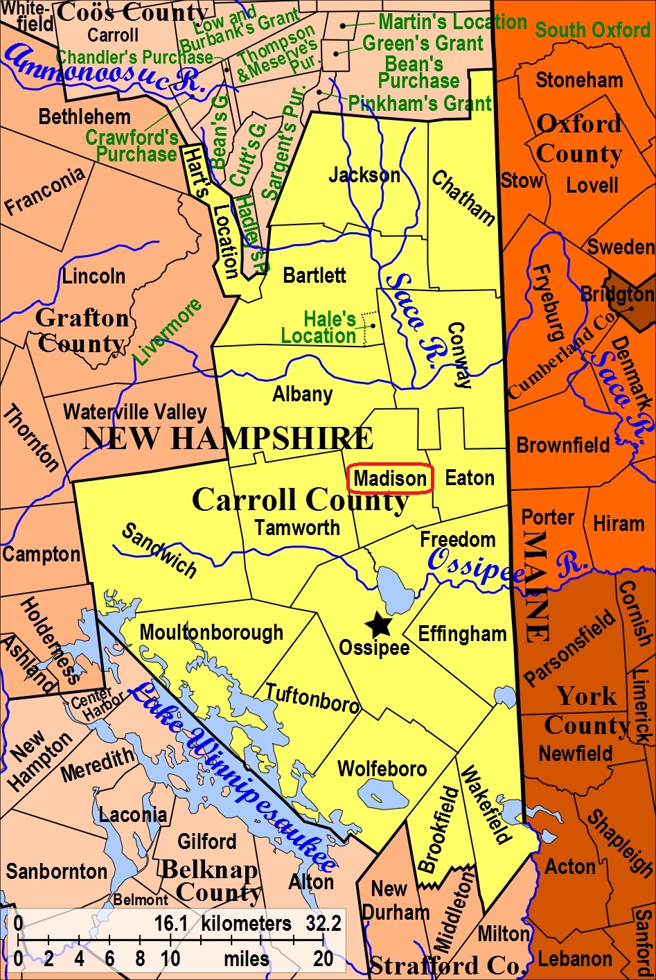
| To see a map of all sites click here. |
| M02-001 Allard, Allard Hill Road, USGS Conway Quadrangle, E32999, N486777, Zone 19 (43° 56' 43.31"N, 71° 7' 6.55"W), (GPS: 43.9454000°N, 71.1180167°W), Source: Russ Battersby 1988, updated from Madison List 2016 MAP |
| M02-036 Allard (Henry), Off Allard Hill Road, near Deer Trot Lane, (GPS: 43.9501833°N, 71.1198833°W), Source: Madison List 2016 MAP |
| ------ Ammi Kennett, See: Kennett (Ammi), M02-041 |
| M02-037 Baker, Off North Division Road, (GPS: 43.9189333°N, 71.1975167°W), Source: Madison List 2016 MAP |
| ------ Banfill/Harriman, See: Banfill/Harriman, C19-030 in Conway |
| ------ Betsey Harmon, See: Harmon (Betsey), M02-003 |
| ------ Bickford (Leonard), See: Merrow, M02-029 |
| M02-004 Blaisdell, Route 153, USGS Freedom Quadrangle, E33197, N485853, Zone 19 (43° 51' 45.64"N, 71° 5' 27.30"W), (GPS: 43.8627167°N, 71.0904167°W), Source: Russ Battersby 1988, updated from Madison List 2016 MAP |
| M02-005 Burke/Wellinghurst, off Daniel Ward Road, USGS Ossipee Lake Quadrangle, E32840, N485983, Zone 19 (43° 52' 25"N, 71° 8' 9"W), Source: Russ Battersby 1988 MAP |
| M02-007 Colby (Eben), Emerson Mtn. USGS Silver Lake Quadrangle, E32876, N486604, Zone 19 (43° 55' 46.24"N, 71° 7' 59.69"W), (GPS: 43.9295833°N, 71.1327000°W), Source: Russ Battersby 1988, updated from Madison List 2016 MAP |
| M02-006 Colby (Thomas), Emerson Mtn. USGS Silver Lake Quadrangle, E32868, N486628, Zone 19 (43° 55' 53.95"N, 71° 8' 3.55"W), (GPS: 43.9317500°N, 71.1337667°W), Source: Russ Battersby 1988, updated from Madison List 2016 MAP |
| M02-008 Danforth, Madison Village Road, USGS Silver Lake Quadrangle, E32888, N486219, Zone 19 (43° 53' 41.64"N, 71° 7' 49.86"W), (GPS: 43.8949500°N, 71.1299500°W), Source: Russ Battersby 1988, updated from Madison List 2016 MAP |
| ------ Daniel Jackson, See: Jackson (Daniel), M02-019 |
| M02-009 Dolloff, off Route 113, USGS Silver Lake Quadrangle, E32760, N486634, Zone 19 (43° 55' 55"N, 71° 8' 52"W), Source: Russ Battersby 1988, updated from Madison List 2016 MAP |
| M02-010 Downes, Loud Road, USGS Conway Quadrangle, E33169, N486302, Zone 19 (43° 54' 10.85"N, 71° 5' 44.94"W), (GPS: 43.9030667°N, 71.0953333°W), Source: Russ Battersby 1988, updated from Madison List 2016 MAP |
| ------ Durgin, See: Durgin, E03-031 in Eaton |
| ------ E. Long, See: Long (E.), M02-023 |
| ------ Eben Colby, See: Colby (Eben), M02-007 |
| ------ Emerson, See: Jackson/Emerson, M02-011 |
| M02-012 Forest/Hubbell, Tasker Hill Road, USGS Silver Lake Quadrangle, E32950, N486929, Zone 19 (43° 57' 32.13"N, 71° 7' 30.27"W), (GPS: 43.9590167°N, 71.1246167°W), Source: Russ Battersby 1988, updated from Madison List 2016 MAP |
| ------ George Merrow, See: Merrow (George), M02-030 |
| M02-015 Gilman (Hannah), Lyman Mountain, USGS Conway Quadrangle, E33080, N486098, Zone 19 (43° 53' 4"N, 71° 6' 22"W), Not located on Madison List. Source: Russ Battersby 1988 MAP |
| M02-013 Gilman Cemetery, East Madison Road, USGS Silver Lake Quadrangle, E32783, N486140, Zone 19 (43° 53' 15.17"N, 71° 8' 35.97"W), (GPS: 43.8875833°N, 71.1427833°W), Source: Russ Battersby 1988, updated from Madison List 2016 MAP |
| M02-014 Goe Hill, Goe Hill Rd. off E. Madison Rd.. USGS Freedom Quadrangle, E32944, N485915, Zone 19 (43° 52' 3.64"N, 71° 7' 21.28"W), (GPS: 43.8677500°N, 71.1220833°W), Also known as Gove Hill. Source: Russ Battersby 1988, updated from Madison List 2016 MAP |
| M02-040 Hamilton, In the woods east of the impassable section of Modock Hill Road, (GPS: 43.9221000°N, 71.1190333°W), Source: Madison List 2016 MAP |
| ------ Hannah Gilman, See: Gilman (Hannah), M02-015 |
| M02-003 Harmon (Betsey), Route 153, USGS Freedom Quadrangle, E33193, N485916, Zone 19 (43° 52' 6.02"N, 71° 5' 29.81"W), (GPS: 43.8684500°N, 71.0911333°W), Source: Russ Battersby 1988, updated from Madison List 2016 MAP |
| M02-020 Harmon (Jonathan), off Route 153, USGS Freedom Quadrangle, E33064, N485987, Zone 19 (43° 52' 27.95"N, 71° 6' 28.37"W), (GPS: 43.8745000°N, 71.1073833°W), Source: Russ Battersby 1988, updated from Madison List 2016 MAP |
| M02-016 Harriman, off Pound Road on Maple Grove Road, USGS Conway Quadrangle, E32951, N486052, Zone 19 (43° 52' 48.07"N, 71° 7' 19.72"W), (GPS: 43.8800500°N, 71.1216500°W), Source: Russ Battersby 1988, updated from Madison List 2016 MAP |
| M02-017 Head, on Rte. 113, USGS Silver Lake Quadrangle, E32763, N486511, Zone 19 (43° 55' 15.17"N, 71° 8' 49.25"W), (GPS: 43.9209667°N, 71.1464667°W), Source: Russ Battersby 1988, updated from Madison List 2016 MAP |
| ------ Henry Allard, See: Allard (Henry), M02-036 |
| ------ Hocking, See: Lowd/Hocking, M02-027 |
| M02-019 Jackson (Daniel), Allard Road, USGS Silver Lake Quadrangle, E32839, N486417, Zone 19 (43° 54' 45.36"N, 71° 8' 14.10"W), (GPS: 43.9126833°N, 71.1367500°W), Source: Russ Battersby 1988, updated from Madison List 2016 MAP |
| M02-018 Jackson at the Majors, Route 113. On the Major Jackson's farm, now called "the Major's". On the road to Conway from Madison, NH. USGS Silver Lake Quadrangle, E32753, N486437, Zone 19 (43° 54' 51.12"N, 71° 8' 52.87"W), (GPS: 43.9143000°N, 71.1475500°W), Graveyard is very near the house. Source: Russ Battersby 1988, updated from Madison List 2016 MAP |
| M02-011 Jackson/Emerson, off Modock Hill Road, USGS Conway Quadrangle, E32958, N486520, Zone 19 (43° 55' 19.72"N, 71° 7' 21.97"W), (GPS: 43.9222000°N, 71.1223167°W), Source: Russ Battersby 1988, updated from Madison List 2016 MAP |
| ------ John March, See: March (John), M02-028 |
| ------ John Merrow, See: Merrow (John), M02-031 |
| ------ Jonathan Harmon, See: Harmon (Jonathan), M02-020 |
| M02-021 Kenison, off Route 113, USGS Silver Lake Quadrangle, E32746, N486307, Zone 19 (43° 54' 8.95"N, 71° 8' 54.49"W), (GPS: 43.9025500°N, 71.1479333°W), Source: Russ Battersby 1988, updated from Madison List 2016 MAP |
| M02-002 Kennett, off Route 153 on East Madison Road, USGS Conway Quadrangle, E32850, N486009, Zone 19 (43° 52' 33.30"N, 71° 8' 4.45"W), (GPS: 43.8759833°N, 71.1340167°W), Source: Russ Battersby 1988, updated from Madison List 2016 MAP |
| M02-041 Kennett (Ammi), North of East Madison Road, (GPS: 43.8774333°N, 71.1101667°W), Source: Madison List 2016 MAP |
| ------ Leonard Bickford, See: Merrow, M02-029 |
| M02-022 Littlefield, Silver Lake, USGS Silver Lake Quadrangle, E32859, N486859, Zone 19 (43° 57' 8.70"N, 71° 8' 10.27"W), (GPS: 43.9525167°N, 71.1356833°W), Source: Russ Battersby 1988, updated from Madison List 2016 MAP |
| M02-023 Long (E.), Modock Hill Road, USGS Conway Quadrangle, E33027, N486616, Zone 19 (43° 55' 51.39"N, 71° 6' 52.15"W), (GPS: 43.9310500°N, 71.1139333°W), Source: Russ Battersby 1988, updated from Madison List 2016 MAP |
| ------ Long (Horace), See: Long (Horace), C19-022 in Conway. On Potter Road just over the Conway town line, listed as C19-022 in Conway. |
| M02-027 Lowd/Hocking, off Bickford Rd, USGS Conway Quadrangle, E33080, N486318, Zone 19 (43° 54' 15.30"N, 71° 6' 24.99"W), (GPS: 43.9043000°N, 71.1064667°W), Source: Russ Battersby 1988, updated from Madison List 2016 MAP |
| M02-026 Lyman, High Street, USGS Silver Lake Quadrangle, E32462, N486219, Zone 19 (43° 53' 38.04"N, 71° 11' 0.66"W), (GPS: 43.8939500°N, 71.1829667°W), Source: Russ Battersby 1988, updated from Madison List 2016 MAP |
| M02-025 Lyman (Robert), off Glines Hill Rd. on Lyman Mtn. USGS Conway Quadrangle, E33187, N486239, Zone 19 (43° 53' 50.59"N, 71° 5' 36.16"W), (GPS: 43.8974700°N, 71.0928700°W), Note: There are several distinct piles of stones (at least four, though there are other mounds that could have stones beneath). It is likely that this could be the cemetery. The Lyman Cellar Hole is nearby at 43.89756°N, 71.09170°W. Not located on Madison List. Source: Russ Battersby 1988. updated Jacob Beauregard 2017 MAP |
| ------ Madison Cemetery, See: Gilman (Hannah), M02-015 |
| M02-028 March (John), off Route 113, USGS Silver Lake Quadrangle, E32764, N486376, Zone 19 (43° 54' 31.45"N, 71° 8' 47.23"W), (GPS: 43.9087833°N, 71.1459000°W), Source: Russ Battersby 1988, updated from Madison List 2016 MAP |
| M02-029 Merrow, off Bickford Rd, USGS Conway Quadrangle, E32921, N486342, Zone 19 (43° 54' 21.76"N, 71° 7' 36.50"W), (GPS: 43.9061500°N, 71.1262500°W), Source: Russ Battersby 1988, updated from Madison List 2016 MAP |
| M02-030 Merrow (George), Modock Hill Road, USGS Conway Quadrangle, E33014, N486591, Zone 19 (43° 55' 43.18"N, 71° 6' 57.69"W), (GPS: 43.9287500°N, 71.1155833°W), Source: Russ Battersby 1988, updated from Madison List 2016 MAP |
| M02-031 Merrow (John), Modock Hill Road, USGS Conway Quadrangle, E32952, N486457, Zone 19 (43° 54' 59.26"N, 71° 7' 23.93"W), (GPS: 43.9165167°N, 71.1228167°W), Source: Russ Battersby 1988, updated from Madison List 2016 MAP |
| M02-032 Mooney, Bickford Road, USGS Silver Lake Quadrangle, E32842, N486340, Zone 19 (43° 54' 20.45"N, 71° 8' 11.86"W), (GPS: 43.9057167°N, 71.1361500°W), Source: Russ Battersby 1988, updated from Madison List 2016 MAP |
| ------ Noyes Place, See: Allard, M02-001 |
| M02-033 Old Public Cemetery, off Route 113, USGS Silver Lake Quadrangle, E32755, N486196, Zone 19 (43° 53' 33.07"N, 71° 8' 49.16"W), (GPS: 43.8925833°N, 71.1464500°W), Source: Russ Battersby 1988, updated from Madison List 2016 MAP |
| M02-042 Osgood, Route 113, (GPS: 43.8884167°N, 71.1682833°W), Source: Madison List 2016 MAP |
| M02-034 Quint, Oak Hill Road, USGS Silver Lake Quadrangle, E32855, N486833, Zone 19 (43° 57' 0.24"N, 71° 8' 11.76"W), (GPS: 43.9501500°N, 71.1361500°W), Source: Russ Battersby 1988, updated from Madison List 2016 MAP |
| ------ Robert Lyman, See: Lyman (Robert), M02-025 |
| M02-043 Salter, Salter Hill, (GPS: 43.9326333°N, 71.1916167°W), Source: Madison List 2016 MAP |
| M02-035 Ward, off Daniel Ward Road, USGS Ossipee Lake Quadrangle, E32861, N485874, Zone 19 (43° 51' 49.66"N, 71° 7' 57.96"W), (GPS: 43.8638833°N, 71.1322667°W), Source: Russ Battersby 1988, updated from Madison List 2016 MAP |
| ------ Wellinghurst, See: Burke/Wellinghurst, M02-005 |
Listings Copyright © 1998-2024 New Hampshire Old Graveyard Association.
All rights reserved.
Send mail to webmaster@nhoga.org with questions or comments about this web site.